Perfect temperatures, no rain, and little smoke.
What is left to say?
Substantial rain last week has knocked back the smokers in British Columbia and there are only a few small fires over the southern Cascades. FAR less fires than normal in fire-prone California.
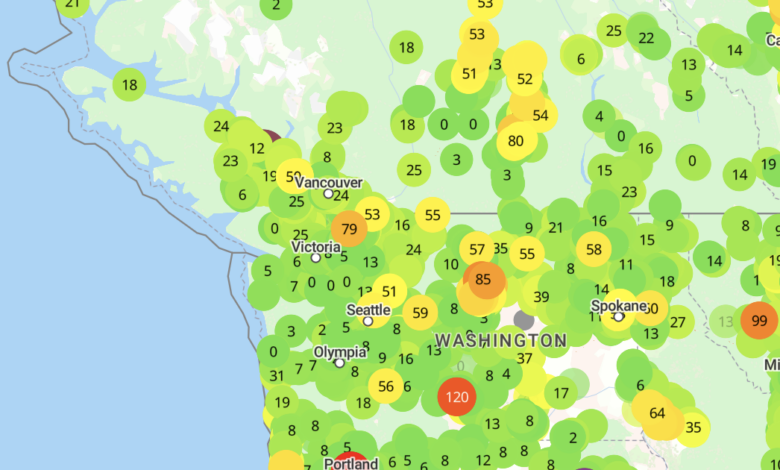
Thus, the latest Purple Air surface air quality sites indicate mainly green colors (good air quality) over the Northwest, including much of southern BC.

And the NOAA HRRR smoke model has a very benign surface air quality forecast for 5 PM Friday (see below).

The latest weather.com forecast for Seattle suggests a slow warming into Saturday, but nothing extreme…77F. (see below)
Close to perfect. Followed by a modest cool-down next week.

Eastern Washington will top out around 90F over the weekend.
I really wish I could forecast some weather excitement, but we have a boringly optimal period ahead.
But changes are occurring to our north and west. The temperature difference between the subtropics and Arctic regions is growing and that helps drive the upper tropospheric jet stream, centered around 30,000 to 35,000 ft.
The figure below shows the winds around 30,000 ft next Tuesday, with the jet stream indicated by the stronger winds (green to orange and red colors). The jet stream, which acts as a conduit for storms, will be headed into BC.
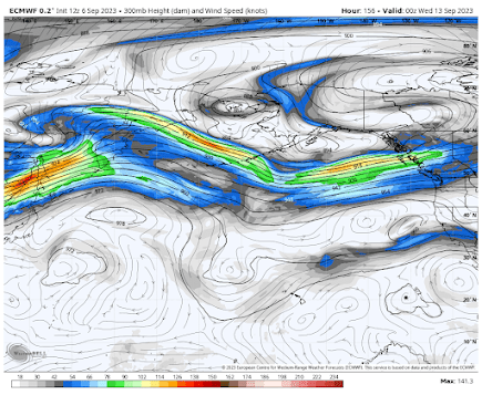
With a persistent jet stream to our north, BC and southeast Alaska will get plenty of precipitation (see total through Wednesday below). Gray and reds are the most.

During October the jet stream will slide south and the moisture stream will reach us.
But enjoy perfect weather in the meantime.