It has been often said that it is darkest before the dawn.
Well folks, we have been very dark and dawn is a long way off.
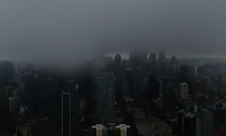
The image from the Seattle SpaceNeedle at noon Wednesday, was dismal at best (see below)

So what do the numbers say? How dark have we really been?
The last two days have been abysmal, with 0.57 and 0.87 MJ (megajoules) per square meter. During the midsummer we often get above 30.

What about Pasco in the Columbia Basin? Surely that location would be brighter! (see below).
Nope, the same story.

The trouble is that we start with a relatively northerly latitude with short days…. so there is meager solar radiation to start with.
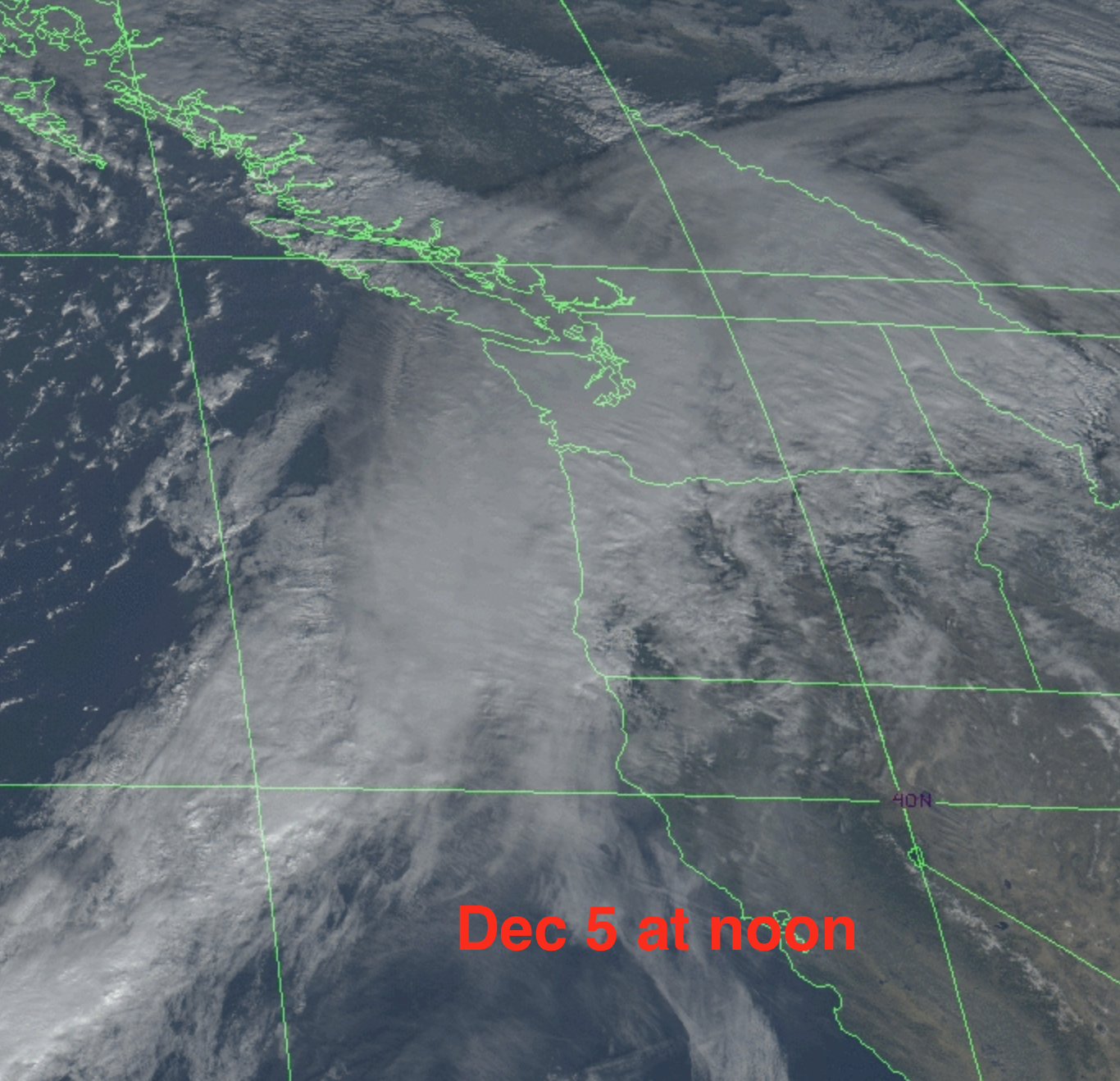
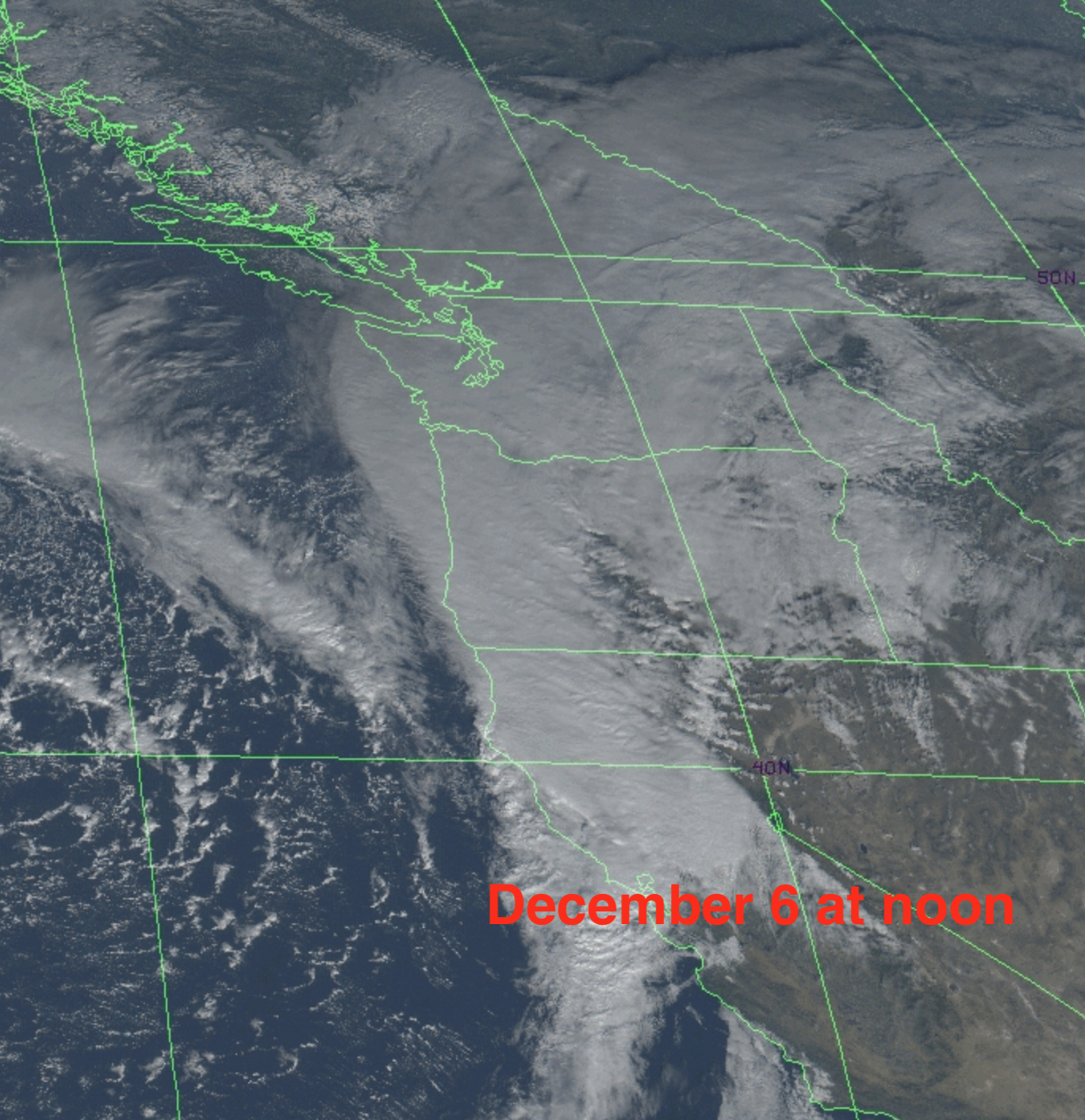
Then we add very thick, deep clouds from a strong atmospheric river. Plus lots of precipitation. The visible satellite imagery at noon for December 5 and 6 are shown below. The atmospheric river/frontal clouds are clearly visible and had spread over both sides of the Cascades.
The combination of weak sun, short days, and plentiful clouds makes solar energy problematic in our region during the winter. Take a look at the average solar resource (the fancy name is irradiance) for December. Not much in the Northwest. A different (and better) story over the desert U.S. southwest.

Weather forecasting models predict solar radiation reaching the ground, something I have never shown in the blog until today. But now I will give you a peek!
The forecast for 1 PM today shows dark colors (less sun) over the region with the murk being particularly bad over the western slopes of the Cascades.

Saturday looks better in northern CA, but far worse in western Oregon and Washington. Why? Because ANOTHER atmospheric river is coming in.

Want solar relief? It will be much brighter on Tuesday (see below) as a ridge of high pressure builds (temporarily) over the eastern Pacific.
Get your sunglasses ready.😊


![Ukraine War Helps “Communicate Needs” [Climate] Sacrifice” - Frustrated with that?](https://news7g.com/wp-content/uploads/2022/03/Oliver-Twist-390x220.jpg)