The current forecast for rainfall in northwest Washington over the next few days is incredible…..especially the amount of rain that will fall tonight.
Many daily records will be broken.
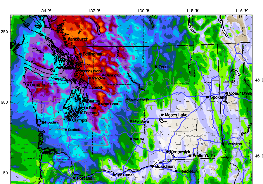
Looking at accumulated rainfall through 5pm Saturday.
Unbelievable. Large areas of northwest Washington will get more than two inches, about 3-6 inches.

Most of this rain will fall overnight. Even more rain will fall on Monday, with totals through 5am Tuesday shown below. There will be localised flooding around Bellingham.

Remember, August is a dry month. Consider the historical records in Bellingham on August 24 (see below). The highest rainfall total on August 24 was 1.12 inches. That record will be broken… as will many others.

The average monthly rainfall in Bellingham is 1.13 inches…. normal rainfall will be disrupted.
As noted in previous blogs, the cause of this wet period is a record deep closed low pressure area/trough aloft (see graphic below at 5pm today (Friday) at 500 hPa, about 18,000 ft).

This downpour will end the wildfire season in northwest Washington. But let’s not forget southern Oregon and northwestern California, where it will also be very wet.

Finally, I have criticized the Seattle Times for their inaccurate and exaggerated information about heat, drought, and climate change. So let me admit that they finally did an article highlighting the cold and rain. 😀