Today was cool, mostly cloudy, with some showers. There was a real autumn feel to the air. Days are rapidly getting shorter and the strength of the sun is noticeably less.
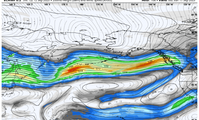
Rapidly, the jet stream…the strong west-to-east current of air in the upper troposphere.. has strengthened….and the forecast of upper-level winds for Saturday afternoon shows a strong current of winds extending across the Pacific (see below). Reds are the strongest winds.
The jet stream is driven by the north-south temperature difference, so as the Arctic rapidly cools, the temperature change and associated jet stream strengthen.

Right now, most of the jet stream action is north of us, but late Sunday and Monday, western Washington and BC will get a piece of it. Below is the 72-hour total precipitation ending 5 AM Wednesday. Wow. Southern BC will get some heavy rain.

As the jet stream and cooler air slide towards us, temperatures will not get out of the 60s early next week in Seattle (see below).