Colorado River Flow Data Disproves “Climate Change Warming” Computer Model Flow Reduction Claims • Watts Up With That?

Guest essay by Larry Hamlin
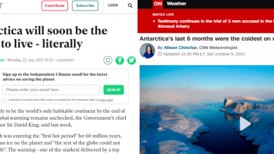
The Orange County Register published a prior Denver Post article claiming that “climate change warming” had caused a 20% reduction in Colorado River flow since 1900 as shown below.

The Denver Post article (as published in the Orange County Register) notes:
“First, the river is drying as the West becomes warmer and more arid. Warmer temperatures speed evaporation, further reducing a lack of water from less precipitation. One report by the U.S. Geological Survey found the Colorado River’s flows have dropped by 20% since 1900 primarily due to warming.”
The U.S. Geological Survey report referenced in the Denver Post article then references a February 2020 study “recently published in Science” which notes:
“The sensitivity of river discharge to climate-system warming is highly uncertain, and the processes that govern river discharge are poorly understood, which impedes climate-change adaptation.”
“A Monte Carlo simulation with a radiation-aware hydrologic model resolves the longstanding, wide disparity in sensitivity estimates and reveals the controlling physical processes.”
This computer model simulation is then used to “estimate” the following outcome for Colorado River flows as:
“We estimate that annual mean discharge has been decreasing by 9.3% per degree Celsius of warming because of increased evapotranspiration, mainly driven by snow loss and a consequent decrease in reflection of solar radiation.”
Thus, the claim that “the Colorado River flows have dropped by 20% since 1900 primarily due to warming” is driven by a “computer model simulation” which was intended to reveal the “controlling physical processes” regarding Colorado River flows into Lake Mead.
The Denver Post article never addresses any measured data regarding Colorado River flows into Lake Mead with this data readily available from the U.S. Bureau of Reclamation covering the period from 1930-2019.
Additionally, neither data of the Upper Colorado River Basin Snowpack levels during this same period that feed the Colorado River nor data of the changing supply and demands from the Colorado River water’s many users during this period is addressed in the Denver Post article.
The peer review “study” published in Science assumes the lower levels of Lake Mead are caused by reduced flows from the Colorado River and then uses a “Monte Carlo simulation” computer model to determine how “climate change warming” caused this reduced flow of the Colorado that resulted in lower water levels in Lake Mead.
Climate scientist Dr. Roy Spencer evaluated measurement records of inflows of the Colorado River at Lees Ferry starting in the 1930s as well as measurements of snow levels at the upper Colorado basis over this period which is the primary source supplying Colorado River flows arriving at Lees Ferry.
Dr. Spencer’s study and analysis of measured data regarding the Lake Mead Elevation changes since 1940 and the Colorado inflows since 1930 is shown below.

Key highlights from the study are noted as:
- Contrary to claims that drought is causing Lake Mead water levels to fall, the Colorado River natural flows into Lake Mead show no long-term trend since 1930.
- Decadal time scale variations in river flow do occur, though, related to the Pacific Decadal Oscillation (PDO).
- Since about 2000, use of Lake Mead water has exceeded river inflow, causing water levels to drop. The negative phase of the PDO since that time has exacerbated the problem.
Data from the U.S. Bureau of Reclamation (USBR) establish that there has been no long term-term trend in the natural Colorado River flow into Lake Mead as shown in detail below from Figure 1 of Dr. Spencer’s study.

Data from snowmelt in the Upper Colorado River Basin Snowpack that feeds the water entering Lake Mead is shown below in Figure 3 of Dr. Spencer’s study which shows there is no long-term trend in snowpack measurements in the period 1938-2022.

Dr. Spencer’s study addresses the declining water levels of Lake Mead since about year 2000 by establishing that downstream water user demands have significantly exceeded water input into the lake as shown in Figure 2 below from a Bureau of Reclamation study published in 2012 that identified this excessive Colorado River water demand problem issue.

Dr. Spencer’s study addresses the impact of naturally occurring climate behaviors such as the Pacific Decadal Oscillation as contributing to changes that affect weather patterns over the Northeast Pacific which ultimately impact the long-term Colorado River snowpack levels of this region.
The conclusions form Dr. Spencer’s study are noted as follows:
“The popular narrative that drought due to climate change is causing Lake Mead to have less water available to it is incorrect. Since 1930, there has been no long-term change in the Colorado River flow upstream of what is now Lake Mead.
The latest climate models do not even predict a reduction in precipitation in the upper Colorado River watershed. (Dr. Spencer utilizes CMIP6 model predicted average yearly precipitation 1930-2050 over an area approximating the upper Colorado River watershed to establish this finding)
Multi-decadal changes in river flow do occur, though, and are related to the Pacific Decadal Oscillation, a natural fluctuation in weather patterns over the northeast Pacific. Recent record-low water levels in Lake Mead are primarily due to record high water demand from the lake, since approximately 2000. The problem is being made somewhat worse by the negative phase of the PDO, also since approximately 2000.”
The Denver Post article’s claim of “climate change warming” impacts being responsible for the declining water levels of Lake Mead as determined by a “computer model simulation” are unsupported and completely contradicted by readily available measures of Upper Colorado River Basis snow levels and USBR water inflow data for the Colorado River flowing into Lake Mead.
Colorado River Flow Data Disproves “Climate Change Warming” Computer Model Flow Reduction Claims
Guest essay by Larry Hamlin
The Orange County Register published a prior Denver Post article claiming that “climate change warming” had caused a 20% reduction in Colorado River flow since 1900 as shown below.

The Denver Post article (as published in the Orange County Register) notes:
“First, the river is drying as the West becomes warmer and more arid. Warmer temperatures speed evaporation, further reducing a lack of water from less precipitation. One report by the U.S. Geological Survey found the Colorado River’s flows have dropped by 20% since 1900 primarily due to warming.”
The U.S. Geological Survey report referenced in the Denver Post article then references a February 2020 study “recently published in Science” which notes:
“The sensitivity of river discharge to climate-system warming is highly uncertain, and the processes that govern river discharge are poorly understood, which impedes climate-change adaptation.”
“A Monte Carlo simulation with a radiation-aware hydrologic model resolves the longstanding, wide disparity in sensitivity estimates and reveals the controlling physical processes.”
This computer model simulation is then used to “estimate” the following outcome for Colorado River flows as:
“We estimate that annual mean discharge has been decreasing by 9.3% per degree Celsius of warming because of increased evapotranspiration, mainly driven by snow loss and a consequent decrease in reflection of solar radiation.”
Thus, the claim that “the Colorado River flows have dropped by 20% since 1900 primarily due to warming” is driven by a “computer model simulation” which was intended to reveal the “controlling physical processes” regarding Colorado River flows into Lake Mead.
The Denver Post article never addresses any measured data regarding Colorado River flows into Lake Mead with this data readily available from the U.S. Bureau of Reclamation covering the period from 1930-2019.
Additionally, neither data of the Upper Colorado River Basin Snowpack levels during this same period that feed the Colorado River nor data of the changing supply and demands from the Colorado River water’s many users during this period is addressed in the Denver Post article.
The peer review “study” published in Science assumes the lower levels of Lake Mead are caused by reduced flows from the Colorado River and then uses a “Monte Carlo simulation” computer model to determine how “climate change warming” caused this reduced flow of the Colorado that resulted in lower water levels in Lake Mead.
Climate scientist Dr. Roy Spencer evaluated measurement records of inflows of the Colorado River at Lees Ferry starting in the 1930s as well as measurements of snow levels at the upper Colorado basis over this period which is the primary source supplying Colorado River flows arriving at Lees Ferry.
Dr. Spencer’s study and analysis of measured data regarding the Lake Mead Elevation changes since 1940 and the Colorado inflows since 1930 is shown below.
Key highlights from the study are noted as:
- Contrary to claims that drought is causing Lake Mead water levels to fall, the Colorado River natural flows into Lake Mead show no long-term trend since 1930.
- Decadal time scale variations in river flow do occur, though, related to the Pacific Decadal Oscillation (PDO).
- Since about 2000, use of Lake Mead water has exceeded river inflow, causing water levels to drop. The negative phase of the PDO since that time has exacerbated the problem.
Data from the U.S. Bureau of Reclamation (USBR) establish that there has been no long term-term trend in the natural Colorado River flow into Lake Mead as shown in detail below from Figure 1 of Dr. Spencer’s study.
Data from snowmelt in the Upper Colorado River Basin Snowpack that feeds the water entering Lake Mead is shown below in Figure 3 of Dr. Spencer’s study which shows there is no long-term trend in snowpack measurements in the period 1938-2022.
Dr. Spencer’s study addresses the declining water levels of Lake Mead since about year 2000 by establishing that downstream water user demands have significantly exceeded water input into the lake as shown in Figure 2 below from a Bureau of Reclamation study published in 2012 that identified this excessive Colorado River water demand problem issue.
Dr. Spencer’s study addresses the impact of naturally occurring climate behaviors such as the Pacific Decadal Oscillation as contributing to changes that affect weather patterns over the Northeast Pacific which ultimately impact the long-term Colorado River snowpack levels of this region.
The conclusions form Dr. Spencer’s study are noted as follows:
“The popular narrative that drought due to climate change is causing Lake Mead to have less water available to it is incorrect. Since 1930, there has been no long-term change in the Colorado River flow upstream of what is now Lake Mead.
The latest climate models do not even predict a reduction in precipitation in the upper Colorado River watershed. (Dr. Spencer utilizes CMIP6 model predicted average yearly precipitation 1930-2050 over an area approximating the upper Colorado River watershed to establish this finding)
Multi-decadal changes in river flow do occur, though, and are related to the Pacific Decadal Oscillation, a natural fluctuation in weather patterns over the northeast Pacific. Recent record-low water levels in Lake Mead are primarily due to record high water demand from the lake, since approximately 2000. The problem is being made somewhat worse by the negative phase of the PDO, also since approximately 2000.”
The Denver Post article’s claim of “climate change warming” impacts being responsible for the declining water levels of Lake Mead as determined by a “computer model simulation” are unsupported and completely contradicted by readily available measures of Upper Colorado River Basis snow levels and USBR water inflow data for the Colorado River flowing into Lake Mead.


