The developing El Nino is “swinging for the fences” and will almost certainly be in the “strong” category this winter, with its effects having an enhanced chance of being significant.
An El Nino is considered “strong” when the sea surface temperature difference from normal in the central equatorial Pacific is more than 1.5°C for at least three months in a row.
The observations suggest this is already happening.
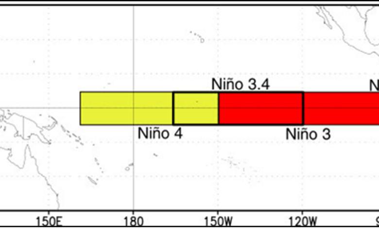
The area used to define El Nino (and La Nina) events is the Nino 3.4 zone in the central tropical Pacific (see map below).

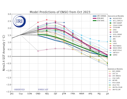
The observed sea surface temperature in the Nino 3.4 area (see below) has been at or above 1.5C above normal for three months—and it is not done strengthening.

As I have mentioned many times, the correlation of El Nino with our fall weather is weak, consistent with the near-normal autumn so far. But after the new year, El Nino impacts increase and strong El Ninos tend to have greater impact.
For western Washington, January-March tends to be warmer than normal during El Nino years (by about 1°F). Neutral years represent more typical conditions.

While for the same months, the region is generally drier than normal by about 2 inches.

California has an opposite correlation, with the Golden State usually wetter than normal during El Nino periods.