A well-timed cooler/wetter period is now ahead, which should reduce the potential for local wildfires next week.
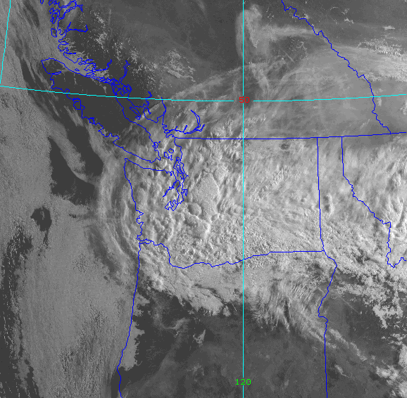
This morning, a band of clouds with embedded cumulus convection extends from Idaho to across the entire State of Washington.

The latest weather radar image shows some rain in this cloud mass, particularly over the southern Cascades and into southwest Washington.

At Crystal Mountain, near Mount Rainier, it is cloudy with some recent light rain:

This could band, associated with a weak atmospheric low-pressure area, was over eastern Oregon and southeast Washington yesterday, resulting in significant rain, particularly over the high plateau of eastern Oregon.

The upper-level atmospheric pattern (500 hPa pressure level, about 18,000 ft) indicates a week low/trough over Oregon–the origin of our pressure clouds and precipitation.

The main rain event will occur on Wednesday and Thursday as a relatively deep low over the Gulf of Alaska extends into BC, producing an unusually strong westerly jet stream coming right into the Northwest (see below). A fall-like pattern.

This pattern will bring rain in western Washington and Oregon on Wednesday, with some locations getting as much as half an inch (see below). BC will get wet as well.

The latest forecast for Seattle from weather.com (a very good source by the way), has moderate temperatures next week (see below).

The Columbia Basin is getting relief from heat today and tomorrow and will only get into the lower to mid-90s this week.
Some modeling systems are going for a major heatwave ten days out, but it is too soon to get excited about it…..the forecast skill at that range is poor.