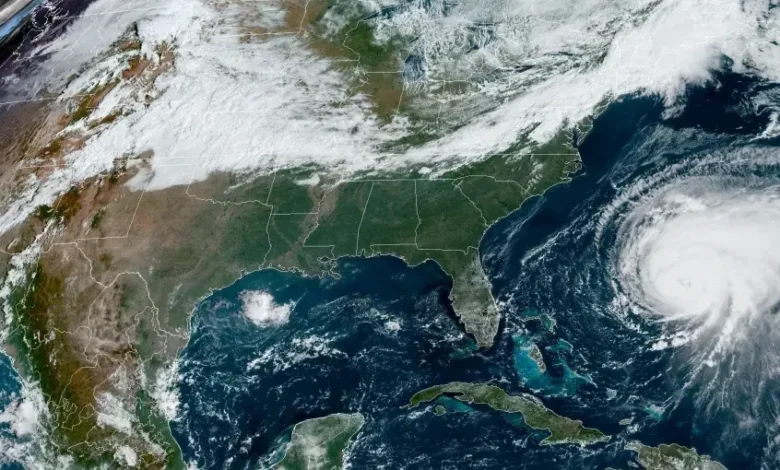
Map of Eastern Canada ravaged by hurricane winds and hurricanes caused by Fiona – Rising for it?
Susan Crockford
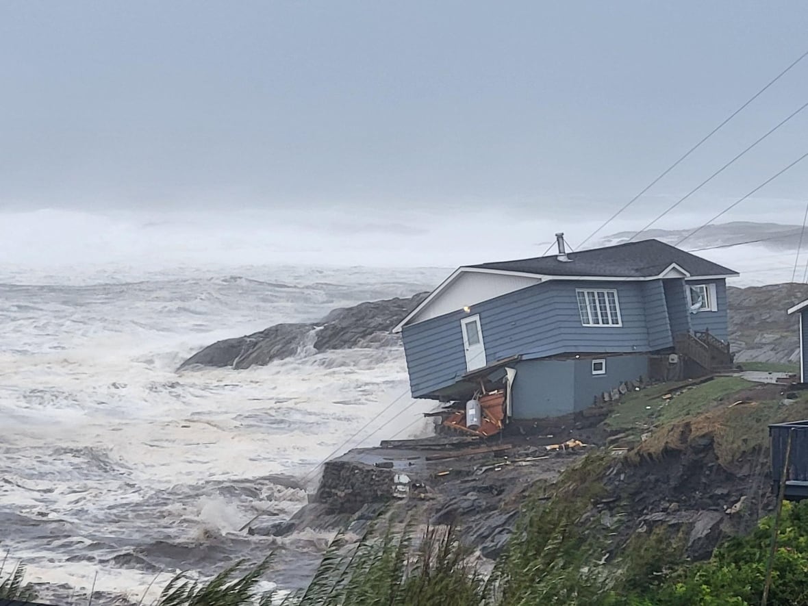
Port aux Basques in SW Newfoundland has been particularly hard hit by Fiona, known as ‘total devastation’. I know the area well from researching my latest science-based novel, UPDATE, about a sea ice tsunami that hits Cape Breton Island and the Port aux Basques area in 2026 causing similar but broader damage. I discovered that many coastal areas in the Gulf of St. Lawrence is only about 10 meters above sea level, and because houses are often built close to shore, they are very vulnerable to high wave heights and storm surge.
Some waves along Nova Scotia’s East Coast could be more than 10 meters high, with waves along southern Newfoundland on Saturday morning reaching higher heights. “Waves over the eastern parts of the Gulf of St. Lawrence and Cabot Strait can be more than 12 meters high,” Environment Canada said. CBC News September 24, 2022.
I can post updates as more information becomes available. Check out the map below to orient yourself to the bulletins.
From my novel, but note that “Epicenter 2026” is the fictitious earthquake that caused the sea ice tsunami in ‘geological novel’ story:
ADDED: Moment of impact video at Port aux Basques, via twitter:
Video from CBC: “Homes lost, residents flee as Fiona smashes Port aux Basques, NL” September 24, 2022