In normal years, we would be coming to the end of the lowland snow season.
Yes, there has been snow during the first weeks of March in the past, but it doesn’t happen often and when it does the snowflake accumulation is light.
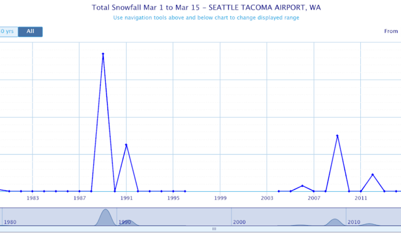
Consider the historical snowfall totals for March 1-15 at SeaTac Airport over the past 50 years (below).

Most years get nothing, but a few have experienced several inches.
The latest forecasts suggest that the mountains will get hit hard by snow and that significant portions of the lowlands, particularly away from the water, will be whitened.
Today, after the warm front passage last night, was too warm for lowland snow, with highs getting into the upper 40s around the western lowlands.
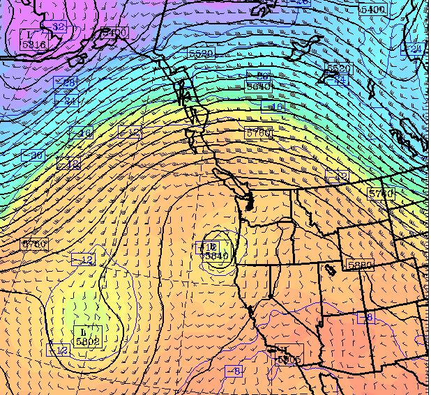
But don’t get too comfortable: a very strong cold front is now moving inland and temperatures and snow levels will plummet.
I knew we were in for a profound cool-down when I saw the visible satellite image this afternoon: the 4 PM image is shown below.
You could see the nearly uniform frontal cloud band with highly unstable showers precipitation offshore (the white and black mottled area). That is our future.

Importantly, a beast of a cold front was found at low levels under the clouds. This intense cold front, indicated by a narrow cold-frontal rainband, was evident in the radar image at 6:35 PM from the Langley Hill radar near Hoquiam (the arrow points to the front and rainband)

The frontal passage this evening will foretell an unusually snowy future for many of you!
The latest UW WRF forecast run has just arrived and is shown below.
The prediction for accumulated snow for the next 24 hours (through 4 PM Thursday) shows substantial snow over the mountains, including the lower slopes. But little over the lowlands.

But the next 24 (through 4 PM Friday) forecast map shows non-trivial lowland snow away from the water. Temperatures are on the edge of rain/snow but the models are going 1-2 inches away from the water.

But the lowland snow fun is not over, with the next 24-h (through 4 PM Saturday) bringing more lowland snow, particularly along the coast and around Portland and Northwest Washington.

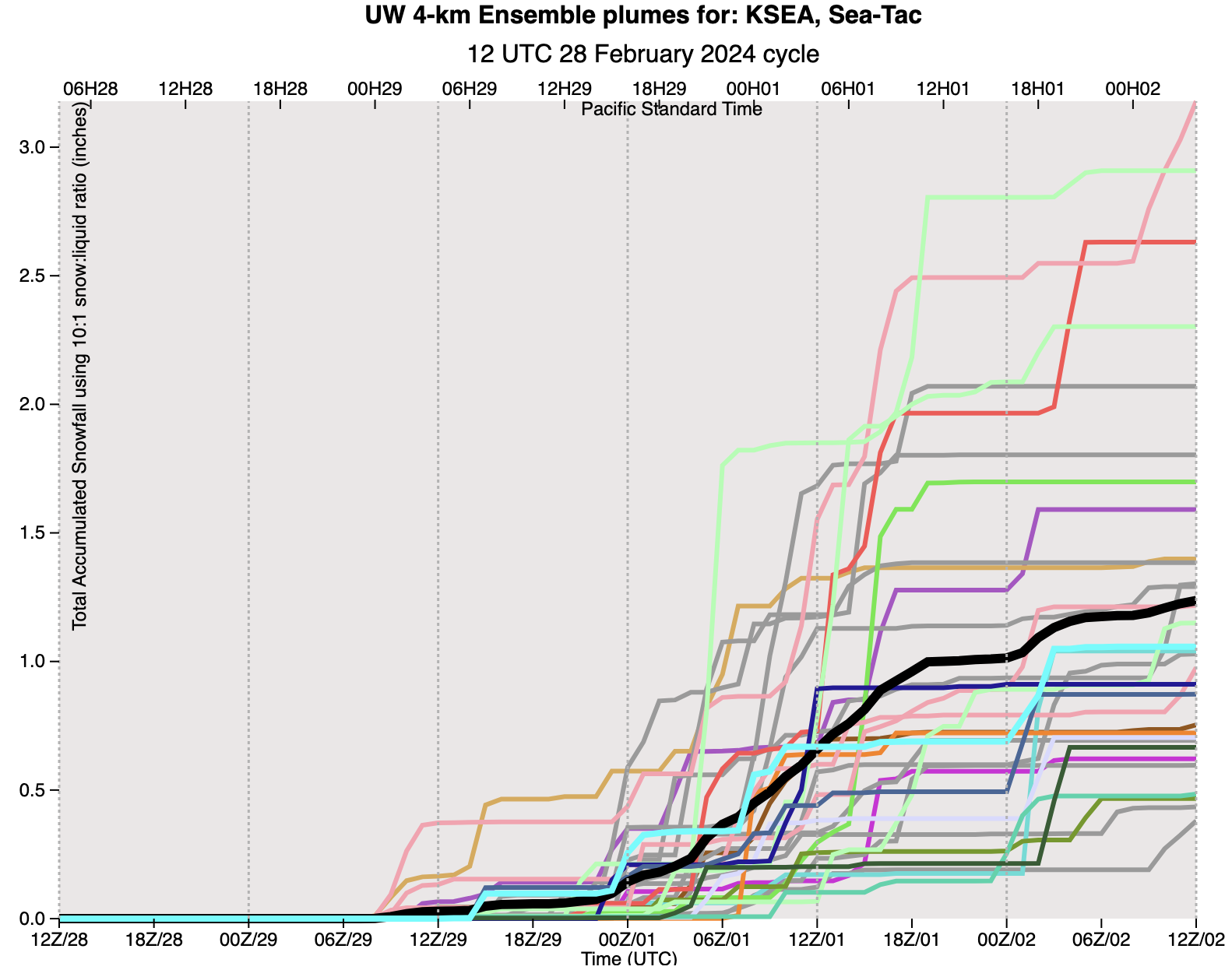
I know….you want to get an idea of the uncertainty of this forecast. No problem.
Below are the predictions of accumulating snowfall total at SeaTac from the UW high-resolution ensemble system in which many forecasts are made…each slightly different. \
A lot of spread in the solutions (the black is the average of them all). Virtually all are going for snow, with total snowfall ranging from 0.5 to 3 inches. So there is some uncertainty….better you are aware of it.
Finally, the uber-skillful European Center model is also going for substantial lowland snow, but in different areas (see the total through 7 PM Saturday.