After a period of high pressure, weak winds, fog, low clouds, and little precipitation, the weather in our region is about to get quite intense and interesting.
Strong winds will soon buffet western Washington and heavy snow (multiple feet) will fall across our regional mountains.
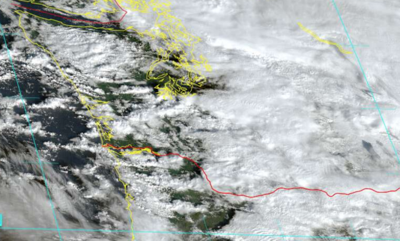
A front went through this morning and our region is now in moist, unstable northwesterly flow as shown by the visible satellite image this morning (below). The white and dark areas offshore are convective showers and you can see the intense cloudiness on the western slopes of the Cascade associated with substantial snow showers.

White-out conditions are now occurring in the mountain passes, illustrated by the WSDOT pass cam below.

Let me show you predicted snow accumulations from the latest University of Washington model forecast.
Through 4 PM the Cascades will get as much as 6-12 inches, and eastern Washington be whitened.

The total through 4 AM Saturday is much more impressive, with 1-2 feet over higher terrain.

And by 4 PM Saturday, many locations will have experienced 2-3 feet. Substantial snow will fall over northeast Washington and northern Idaho.

The snow season will begin with a bang and many ski areas should be able to open. Travel across the passes should be dicey during the next day…so keep that in mind.
And then there are the winds…..
Some of you will experience power outages overnight. I am charging up my devices as soon as I get home from the UW!
A low-pressure system will move eastward to our north, creating a large north-south pressure difference across western Washington (see forecast surface pressure map for 4 AM Saturday). That means strong winds.

The latest NOAA HRRR forecast (available on the City of Seattle Windwatch site built by the UW) predicts powerful winds overnight.
Below are the forecast gusts at 1 and 3 AM. First, the coast and NW Washington will get hit and then Puget Sound, some with winds exceeding 50 mph. Such winds guarantee some power outages.
The only good thing is that many trees have lost their leaves, making them less vulnerable


Considerably more active weather is predicted beyond this weekend, including heavy rain and potential flooding, including a major flood on the Snoqualmie River (see the NW River Forecast Center plot below).

I will talk about that threat in a future blog……one major weather challenge at a time!