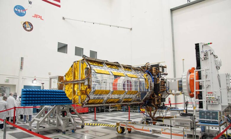
NISAR, short for NASA-ISRO Synthetic Aperture Radar, is ready for transport to its final stop before launch into orbit. Prior to departure, members of the media had a chance to get a close-up look at NISAR’s advanced radar instruments on February 3 in a clean room at NASA’s Jet Propulsion Laboratory (JPL). ) in Southern California. “The time has come for the science center of NISAR – short for NASA-ISRO Synthetic Aperture Radar – an Earth science satellite jointly built by NASA and the Indian Space Research Organization to transport final stop before launch: southern India” NASA said in a report.
“This marks an important milestone in our shared journey to better understand this planet. Earth and our changing climate,” said JPL Director Laurie Leshin. “NISAR will provide important information about the Earth’s crust, ice sheets and ecosystems. By providing measurements with unprecedented accuracy, NISAR’s promise is new understanding and positive impact in communities. Our partnership with ISRO illustrates what can happen when we tackle complex challenges together,” he added.
NISAR will collect radar data using a drum-shaped reflector antenna nearly 40 feet (12 meters) in diameter. It will use a signal-processing technique called interferometer synthetic aperture radar, or InSAR, to observe changes in Earth’s land and ice surface down to tiny fractions of an inch.
Since the beginning of 2021, engineers and technicians at JPL have integrated and tested two NISAR radar systems – the L-band SAR supplied by JPL and the S-band SAR built by ISRO. Later this month, they will transfer the SUV-sized payload into a special cargo container for a 9,000-mile (14,000 km) flight to India’s UR Rao Satellite Center in the city. Bangalore. There it will be merged with the space bus in preparation for the 2024 launch from Satish Dhawan Space Center in the state of Andhra Pradesh.
The observations that NIAR makes will help researchers measure how the Earth is constantly changing by detecting both subtle and powerful movements. Slow-moving variations in the land surface can occur before earthquakes, landslides, and volcanic eruptions, and data on that movement can help communities prepare for natural hazards.
Measurements of sea ice melt and ice sheets will improve understanding of the speed and impact of climate change, including sea level rise. And observations of the planet’s forest and agricultural regions will advance our knowledge of carbon exchange between the atmosphere and plant communities, reducing uncertainty in the models used. to predict the future climate. During its three-year main mission, the satellite will observe nearly the entire planet every 12 days, making observations day and night, in all weather conditions.