A number of locations in the Northwest had their first frost this morning or yesterday morning. Frost season is here.
Below are the low temperatures today for all locations that dropped to 33F or below. Keep in mind these temperatures are for the standard height of 2 meters (roughly 6 ft) above the ground. During the cool season, temperatures often get colder towards the surface.
Several locations in western Washington dropped in the upper 20s, as did observing locations over the Columbia Basin. But if you want real cold, Montana should be your destination; some temperatures bottomed out below 0F!

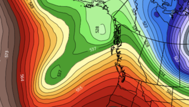
You will notice that Northwest Washington was particularly cold this morning. Want to know why?
Because the skies cleared overnight in that area, allowing the surface to effectively emit infrared radiation to space (see visible satellite image this morning).

Visible satellite image around 9 AM Thursday
So what does the next week look like? Before I show you the predicted temperatures, let me remind you that surface temperatures (where frost is found!) can be several degrees below reported or forecast surface air temperatures, which are valid at 2-meter above the surface.
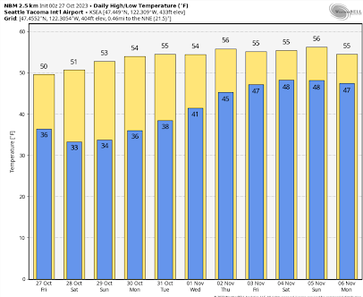
For SeaTac, temperatures are predicted to drop around 33F on Saturday morning. Frost is possible at the Airport!
But for locations a bit away from the water and less urbanized, frost is a near certainty. For example, check out Olympia Airport. Lows down to 27F. Frosty!

Eastern Washington? In Yakima there will be a hard freeze with temperatures getting down to the low twenties on several days.

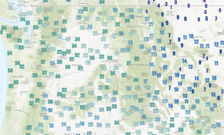
As noted before, the low temperatures depend on distance to water, urbanization, and elevation, with valleys being colder. To illustrate this pattern, below is a very high-resolution prediction of the 2-meter temperatures on Saturday morning at 8 AM from the high-resolution UW modeling system for western Washington.

Below-freezing temperatures are indicated by the blush and purple colors. Warmer near the water and cooler in river valleys. Very cold in the Cascades.
You might ask whether this frosty period in late October is unusual.
For SeaTac Airport, the average day of the first freeze is November 14, so if we do get some frost at the airport during the next few days, it will be about two weeks early. In contrast, for Olympia, the average first frost date is October 6 so freezing temperatures are late there.
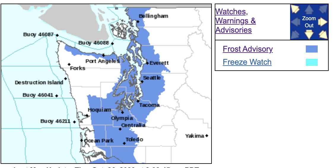
Finally, let me note that the National Weather Service has both a frost advisory and a freeze watch out.