One often thinks of eastern Washington as a place of sunshine and warmth. But during midwinter the opposite is true: the lower elevations of eastern Washington are often dark, cold, and covered by persistent low clouds.
Western Washington is often warmer and sunnier this time of the year.

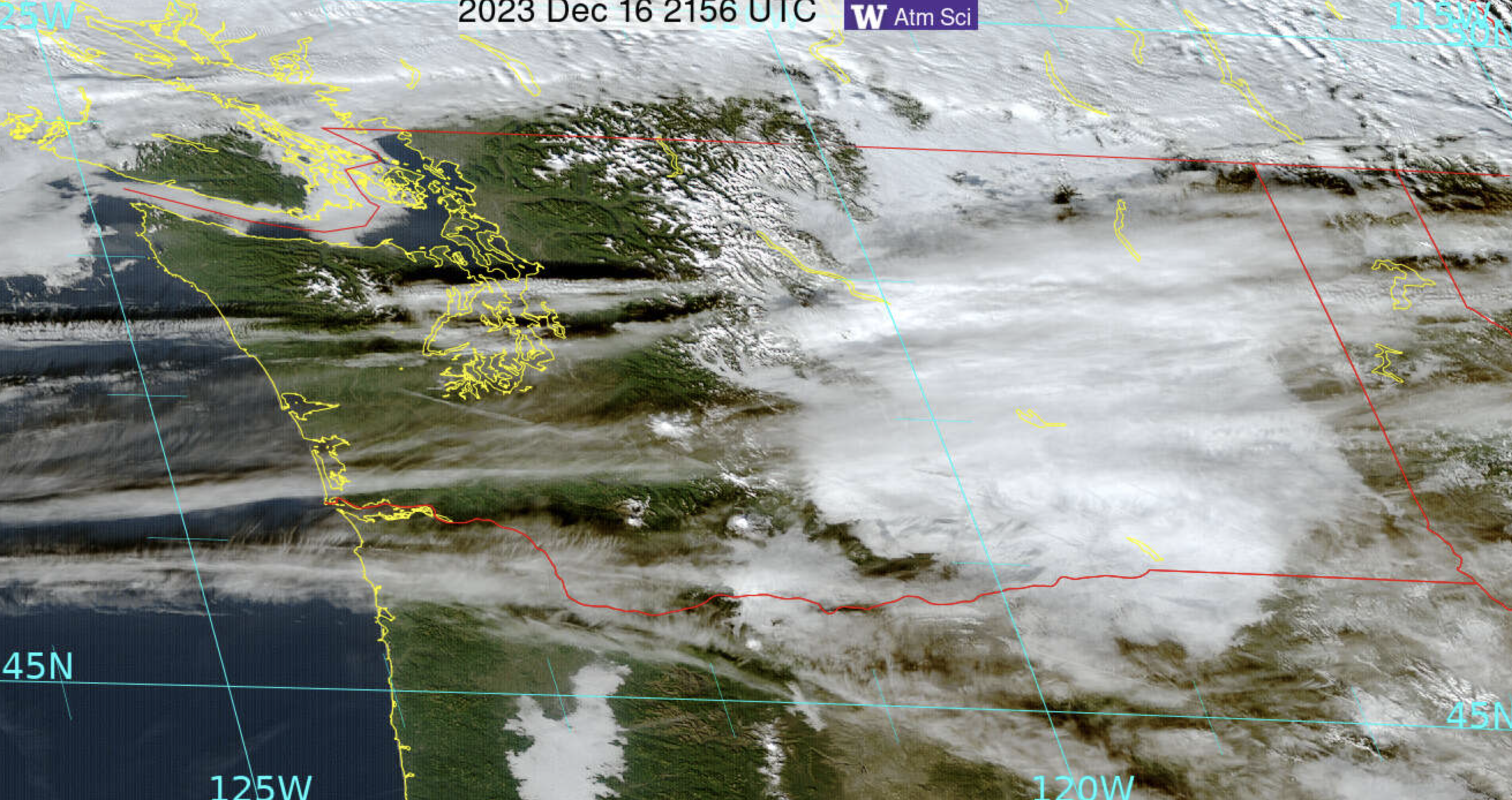
Twin Bridges NW of Richland was in the murk
Consider the visible satellite imagery for the past two days (see below). Eastern Washington was engulfed by low clouds, while western Washington only had some scattered clouds aloft.

High temperatures rose into the upper forties and fifties in western Washington (even some locations hitting 60F!), with mainly 30s over the Columbia Basin.

Solar radiation reaching the surface? A lot more over western Washington!
Looking at Seattle over the past week, four days had peaks in solar radiation exceeding 300 watts per square meter.

Those poor folks at Pasco only got that high (barely) on two days. Expert advice: don’t go to the Tri-Cities to get a sun tan in December or January.


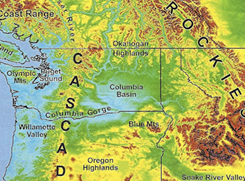
So why is the Columbia Basin so cold and cloudy? Because it is a basin, ringed by higher terrain (see map below). The air cools on the surrounding terrain by infrared radiation to space. Cold air is more dense than warm air and thus sinks to lower elevations. Some cold air from BC can also “sneak” in through the Okanogan Valley on the northern side of the Basin.
Cold air at low levels in the Basin and warmer air above result in an inversion (temperature warming with elevation), which is a very stable feature that acts as a block to atmospheric mixing.
I can show you that such a temperature change with height occurred yesterday (Sunday) through the vertical sounding from a radiosonde, that was launched from Spokane, Washington.
Temperatures (right line) are below freezing (0°C, shown by the red line) in the lower atmosphere, capped by an inversion (blue arrow) of temperatures warming with height. The left line indicated the dew point. The temperature and dewpoint are nearly the same in the low-level cloudy/saturated air. Aloft the air is not saturated and thus are no clouds in that layer.

I better stop now before the Columbia Basin Chamber of Commerce sends a hit team to my office.