To get big waves, you need strong winds, you need the wind to be around for an extended period, and you want a long fetch over water to allow the waves to develop.
Yesterday and today we have all three due to a nearly stationary superstorm offshore.
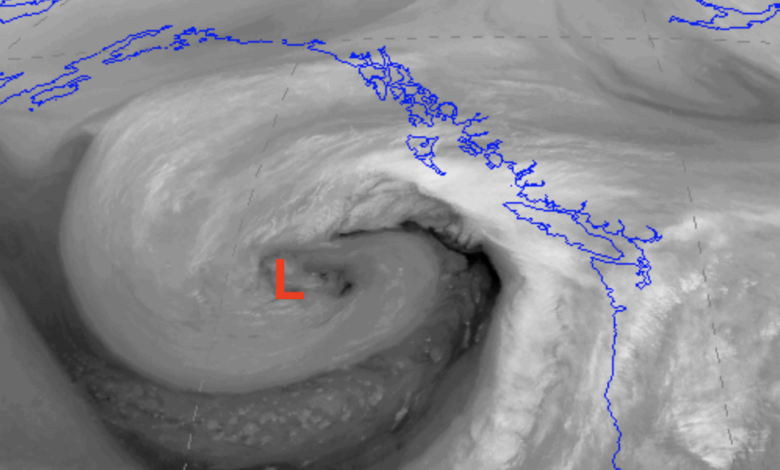
First, we have an impressive storm offshore. Check out the water vapor satellite imagery last night (below), which shows atmospheric water vapor content from space.
Wow… an impressive storm any time of the year, but particularly unusual for mid to late September and unusually far south for late summer. You can see the plume of water vapor heading into our region from the southwest. That means rain.

This is an intense low center, with a central pressure last night of around 963 hPa (see sea level pressure map below, with the solid lines being isobars…lines of constant pressure). That is very low pressure for our neighborhood. The large pressure differences produce very strong winds.

This is an intense, very slow-moving storm and thus winds have an extended time to work on the water.
That means big waves.
The NOAA WaveWatch3 model predicted big waves offshore last night (9 PM shown), with some offshore waves reaching 25 feet.
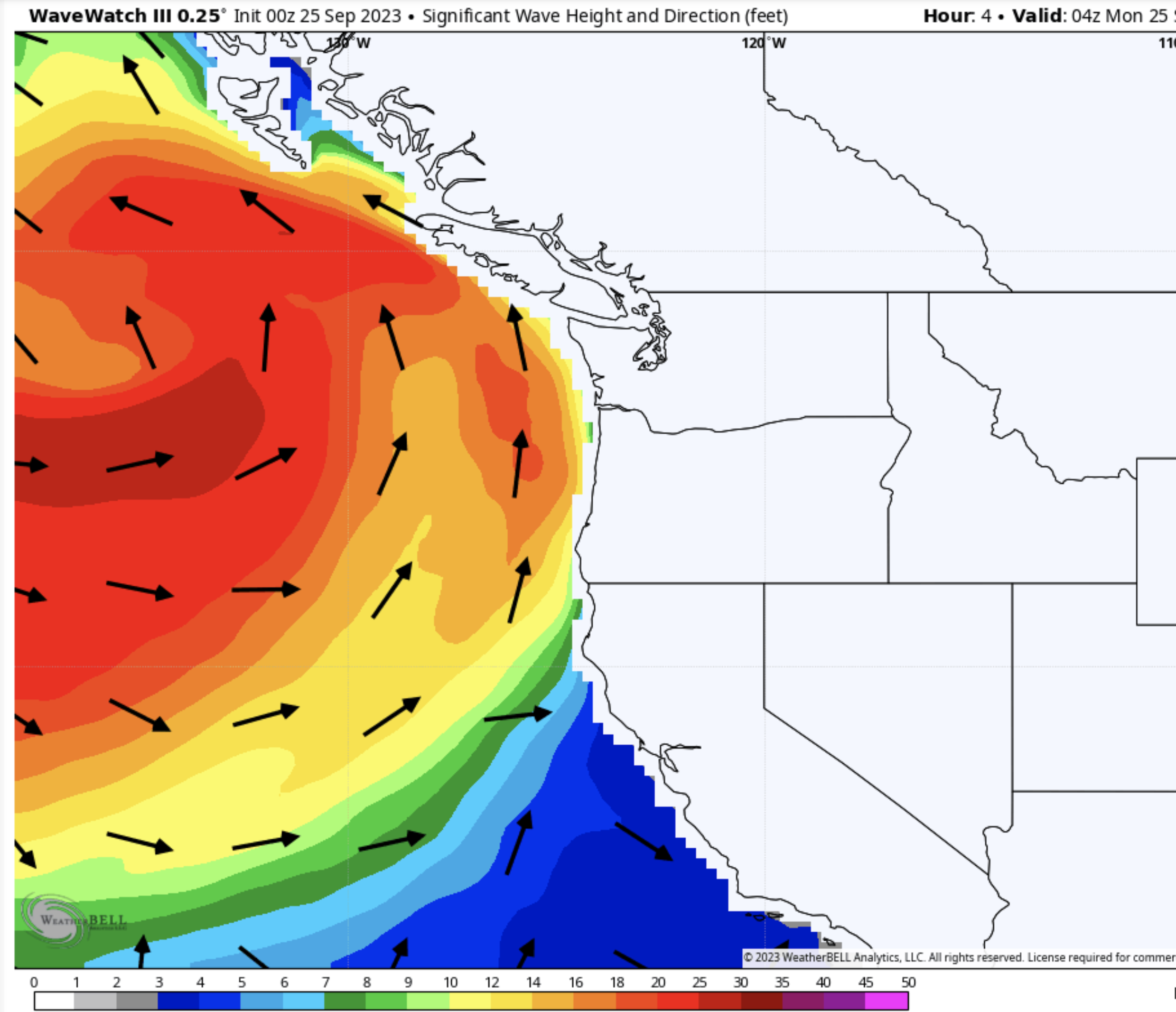
During the day today, some of the big waves will reach the Washington and BC coasts, some reaching over 20 ft (see prediction for 4 PM today). Exciting wave-watching at Westport coming up!

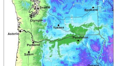
And yes, this is going to be a wet, reservoir-filling week. The latest National Weather Service National Blend of Models total through Friday afternoon is quite soggy west of the Cascade crest…and even easterly WA gets a piece of it.