Guest Post by Willis Eschenbach
In my meand’ring peregrinations of the multiverse, I came across the following about a bay up near the northernwest corner of California.

The article is full of people hyperventilating about the imaginary effects of a claimed three-foot (one meter) sea level rise in “a few decades”.
Riiight … not happening.
I will admit, however, that their claims of a high rate of sea level rise at Humboldt Bay surprised me. Sea levels along much of the northern west coast of North America are small or negative, because of the geological uplift of the land. I expected Humboldt would be the same. Instead, when I went to the NOAA sea level site I found the following. Eureka in the map below is the city on the shores of Humboldt Bay.

So the article is correct in one regard. Measured sea level is indeed rising fast in Eureka … but curiously, the next two tide stations to the north, Crescent City California and Port Orford Oregon, show falling sea levels.
Say what?
I was surprised because the west coast of North America is constantly being wedged upwards by the Pacific tectonic plate. The Pacific plate is diving downwards under the North American plate as they collide. This forces the entire west coast up vertically over geological time.
And surprisingly, in many areas the rate of uplift of the land is greater than the rate of sea level rise, leading to all the scenic cliffs you see in photos of the North Coast. As shown on the map above, the two tide gauge stations nearest to Eureka (Humboldt Bay) are Crescent City, CA, where the sea level is dropping, not rising but dropping, at -0.8 mm per year; and Port Orford, Oregon, which is barely negative but still dropping at -0.06 mm per year.
So Humboldt Bay is an anomaly, with a sea level rise of 5.0 mm per year. What’s going on?
Now, in my fortunately misspent youth, I crab-fished commercially one winter out of Humboldt Bay, freezing my fingers breaking up frozen bait for the crab pots at 5 AM on the way out through the entrance shown below. So I have some understanding of the local turf. Humboldt Bay is a type of bay that is unusual on the west coast of the US but is very common on the east coast. It consists of a long narrow bay created by a long thin natural sand barrier offshore from the mainland, in the form of long sandspits and or sand barrier islands parallel to the mainland coast.
Humboldt is formed by two such long sand spits, imaginatively called “North Spit” and … well, you guessed it. The natural opening between them has been artificially extended by a seawall at the end of each spit, as seen below.

Humboldt Bay, Bay Entrance and City Of Eureka, 40.1°N
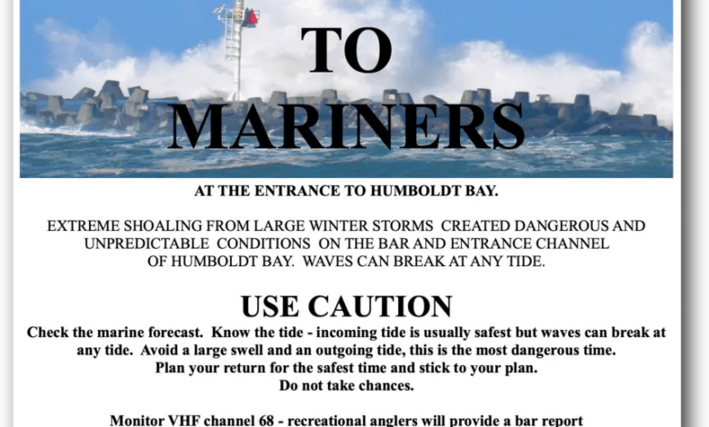
Humboldt is a fearsome bay for fishermen, because during the year an underwater sand bar forms across the entrance. This means that at certain somewhat unpredictable states of wind and tide, you can get a sudden “sneaker wave” that breaks all the way across the space between the seawalls, closing out the entire entrance with whitewater … ugly.
Or the wind can whip the waves up and it breaks constantly across the entire entrance, and the Coast Guard declares the entrance closed, and if you’re outside, it’s a long way and dangerous way to the nearest harbor. Only the Coast Guard goes in or out then, and it’s not pretty.

(And as a man who has worked on the ocean as a commercial fisherman from Monterrey Bay to the Bering Sea, I must take a moment to thank the women and men of the US Coast Guard for putting their lives on the line and being a commercial fisherman’s best friend in time of danger. You folks have the profound appreciation of every commercial fisherman I know.
… an important digression, but a digression nonetheless … so now we return you to your regularly scheduled programming.)
To keep the Humboldt Bay entrance open, it’s necessary to dredge it out every year. The dredged material is ~ 90% sand, 10% silt.
And that brings up an interesting question—the silt is coming from the rivers that feed Humboldt Bay. But where is the endless supply of sand coming from?
The answer is, a beach on the west coast of the US is more accurately described as a hesitation in a slow river of sand flowing endlessly southwards. All the sand almost anywhere on the coast is constantly being moved south by the combined action of the prevailing currents, the beach waves, and prevailing northwest winds. All of these are incessantly picking up bits of sand and moving them just a bit southward.
You can see the shoreside ocean depths by color in the aerial view above. And you can see that having the two artificial seawalls has impeded the southward flow of water and sand. The shallows extend outwards in a circle around the mouth of the seawalled entrance to Humboldt Bay.

Now, if you were putting a tide gauge, would you put it out on the tip of one or the other of the shifting, moving North and South sand spits … or would you put it over on the mainland side of the bay?
Well, one assumes for valid historical reasons, the tide gauge is actually located at the Coast Guard station at the edge of the Samoa Dunes State Recreation Area on the North Spit, in the location shown both above and below.

But not on shore, of course. On a pier. Or to be more accurate, taking up an entire concrete pier. Per the station home page:
The bench marks are on the Coast Guard Base property. The tide gauge is at the east end of the southern pier of two finger piers directly east of the 3-story Coast Guard station building. Station Description: Instruments are hanging in the loft of the Coast Guard Boat House.
Here’s a photo and an overhead view. Looks like a combination two-boat boathouse and tide gauge station.


Further complications abound. Check out the nautical chart below.

The docks and buildings on the upper right side of the graphic above are the Coast Guard station and the location of the NOAA tide gauge.
In the chart above you can see the effect of the north breakwater on the slow southward-flowing river of sand. On the north side, the sand has filled in the corner between the north breakwater and North Spit. It has extended and grown the beach outwards in that corner, and the shallows now extend to the tip of the breakwater.
Sand on the move.
Next, note the regularly dredged entrance channel shown in white. It extends well into the bay. And it’s dredged right up to the edge of the Coast Guard docks to allow for the docking of large vessels.
So: To review the bidding:
• The NOAA tide gauge is located, not on solid ground, not even on mainland ground, but on an offshore barrier spit made of … sand.
• Its nearest neighbor is the Samoa Dunes State Recreation Area, which like North Spit in general is made entirely of … sand.
• The tide gauge is sitting in a large building on massive heavy concrete piers that extend down into … sand.
• The area just farther into the bay from the tide gauge is dredged annually to remove … the sand.
• The local sand flows and the shape of North Spit have been greatly impacted by the construction of two large offshore breakwaters, and by the annual dredging of the entrance channel.
And with that as prologue, are you surprised that the wildly anomalous sea level record strongly suggests that the North Spit tide gauge is slowly sinking into … sand?
The good news is, other than for the small towns of Fairhaven, Manila, and Samoa which were foolishly built right on North Spit, the Humboldt Bay sea level catastrophe is canceled—sorry, no refunds for those who bought tickets.
Those small towns may or may not be sinking—after all, the spits have been there a long, long time. That means that historically, the sand constantly being removed from the spit by wind and water has been replaced by new sand moved onto the spit by wind and water from the ocean side. So for those towns, likely no immediate threat.
The other good news is, I’m sensing a whiff of desperation from the crowd pushing the “EVERYONE PANIC, IN A DECADE WE’LL BE DEAD” line of patter … after five decades of failed serial doomcasting, seems more folks are starting to wise up.
And the best news? That would the fact that I’m still on the green side of the grass, not the brown side … and at 77 years old I give thanks for that every day.
My best to all, hold your friends and family close, seize the day, life is far too short,
w.
My Usual Ask: When you comment, please quote the exact words you are discussing. Makes things clear.
Sea Level Data: North Spit, Crescent City, Port Orford
PS: Why doesn’t NOAA adjust the data for the land subsidence? I suspect it’s from a lack of data. According to Sonel, the “Co-located GPS” is RedwoodsCCCN2004 … which is way down at the south end of the Bay and not located on either of the spits. It shows subsidence, but only at -0.85 mm/year, clearly less than that of the tide gauge at North Spit.