Although the inland Pacific Northwest is escaping most of the serious storm action, one storm after another is revving up over the eastern Pacific, and such storms, with very strong winds near the surface, can result in the generation of big waves that move to our coast.
Rapidly growing, intense storms are often called meteorological “bombs” and several such “explosive cyclones” will be active to our west this week.
This time of the year, there is a further concern, with very large midwinter “King” tides.
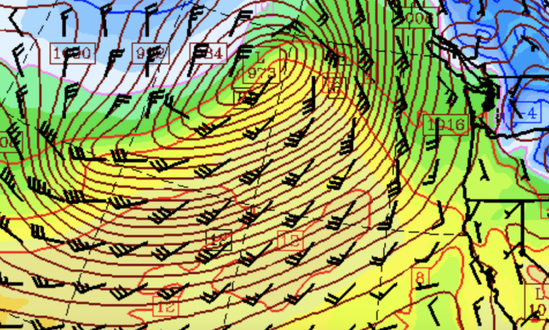
Let me show you some of the forecasts from the UW WRF modeling system, with the maps presenting sea level pressure (solid lines), surface winds (the black wind pennants), and low-level temperature (shading, blue is cold, orange/red is warm)
Monday has a large impressive low off our coast! Very large area of powerful southwesterly winds.

On Wednesday, there are two offshore low systems

And Friday has a huge elongated low west of the Northwest coast.

Strong winds help build waves. Big systems with long stretches of strong winds (or fetch) build waves.
Now let me show you some of the wave forecasts from the NOAA WindWatch3 wave prediction system. The highest waves are indicated by the reds and browns.
Monday night around 8 PM the NOAA system is predicting waves exceeding 20 ft reaching our coast! Large waves will be widespread over the northeast Pacific.

And similarly large or larger waves are predicted around 11 PM on Wednesday.

So expect some good wave-watching on the coast.
What about the high tides? The astronomical predictions (no weather input) forecast some relatively high tides during the next few days, so there will be some coastal flooding/impact concerns.

In fact, the National Weather Service does have a coastal flooding advisory for the next several days (below).