The U.S. West Coast is experiencing a very wet period and this pluvial bounty is not ending soon.
Dramatically, measures of water vapor approaching our coast are impressive.
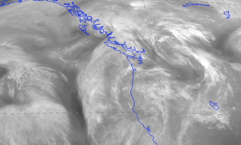
To illustrate, consider the water vapor imagery from the NOAA GOES-West satellite on Saturday afternoon (see below).
I rarely show such imagery on this blog and it is virtually never presented by the media. Where it is white, there is a lot of water vapor in the mid to upper troposphere (roughly 18,000 to 35,000 ft). The image below shows the entire West Coast engulfed in H2O.

Expect little change this week. Currents of water vapor, generally from the subtropics and tropics, are commonly called “atmospheric rivers” and several of them will be headed for the western U.S. this week.
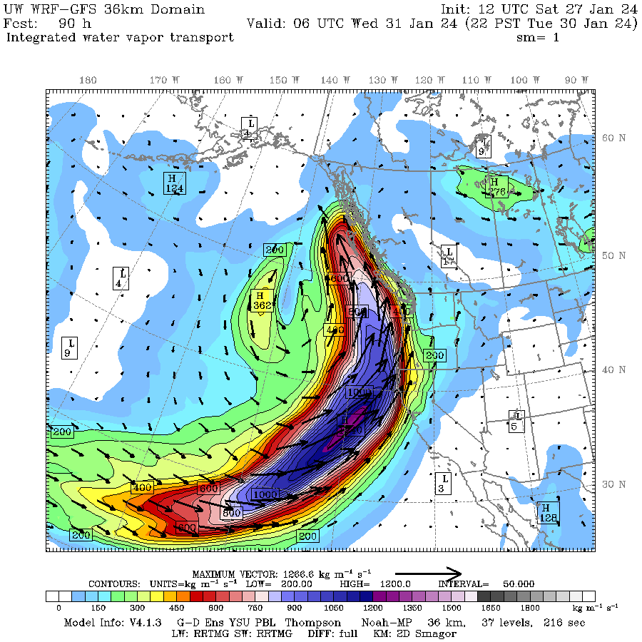
One of the best ways to identify a potent atmosphere river is to plot “water vapor transport”, which is essentially the moisture (water vapor) content of the atmosphere times the associated wind speed. Essentially a measure of how much water vapor is being moved about by the winds.
The predicted atmospheric river and associated water vapor transport this evening (Sunday) are impressive (blue colors), with the most potent influx of water into British Columbia.

But if you REALLY want to be impressed, check out the atmosphere river prediction for Tuesday evening. Just wow. And this one is headed for northern California and the Pacific Northwest.
The predicted 48-h precipitation totals ending Friday morning are impressive over northern California and British Columbia gets a big piece of it as well:

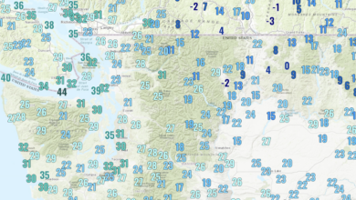
Many West Coast rivers will be running high. In fact, they are already running high with numerous NW rivers much above normal on Saturday (see below).


Stay dry,