The region has palpably entered a fall-like period of cooling temperatures and the return of precipitation.
But to quote the old saw: “You Ain’t Seen Nothing Yet”
A moderate frontal system will move in tomorrow (Tuesday) night, bringing rain across the region (see total through 5 PM Thursday below). Maybe a half-inch in the Cascades.
Enough to knock back local fires to a smolder.

But the real action is still ahead. A weak front will move in Saturday morning (see 24 hr precipitation ending 5 PM Saturday).

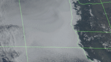
But that is not the main story. Early next week a potent atmospheric river of substantial moisture will be headed into our region (see total water in a vertical column for 5 PM Monday). Mama Mia! That is a decent atmospheric river. Blue indicates lots of water vapor heading our way.

The result will be bountiful local rainfall, as the moist air is forced to rise by our regional terrain.
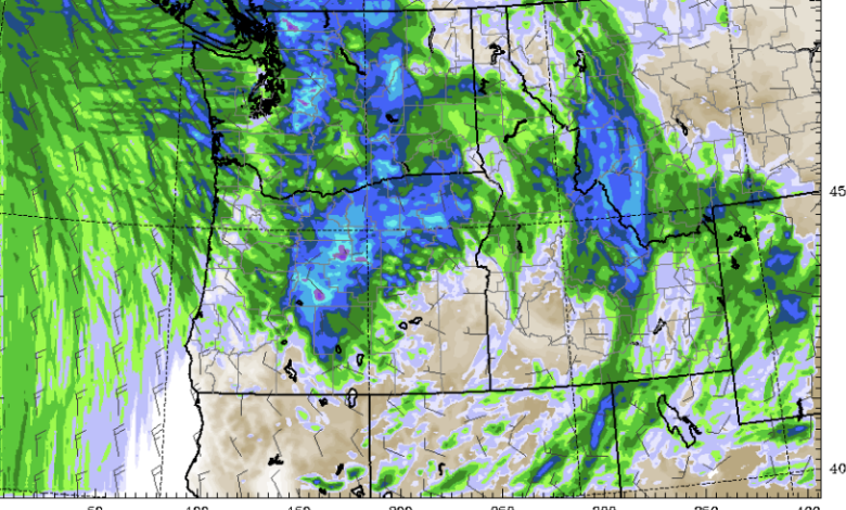
The 24-hour precipitation total ending 5 AM Tuesday includes several inches in our mountains.

And the 72h precipitation total ending Wednesday morning has as much as ten inches at high elevations. Wow.

Folks this will end the local wildfire season, which has been below normal this year. And with lots of moisture coming in and moderating temperatures, the higher elevations will start to pick up the first snow of the season (see forecast snow total map through September 28).