There is an interesting mix of weather this weekend.
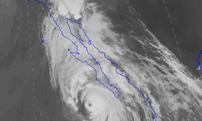
On one hand Hurricane Hilary, soon to be a tropical storm, is off the southern tip of Baja and moving quickly northward (see satellite image his AM). A current of enhanced amounts of water vapor leads the storm resulting in substantial precipitation even now over the Southwest U.S.

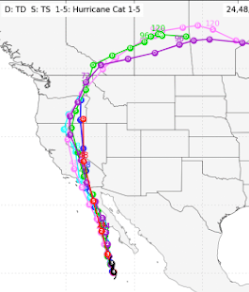
The storm path is now clear, with the remnant of Hilary passing over eastern Oregon and Washington! (see below). An ex-tropical storm over Washington State…
Although Hilary will now rapidly weaken, it will produce very heavy rain over the U.S. Southwest and lighter rain over eastern Oregon and Washington. The predicted precipitation through Tuesday by the NOAA Weather Prediction Center is shown below.
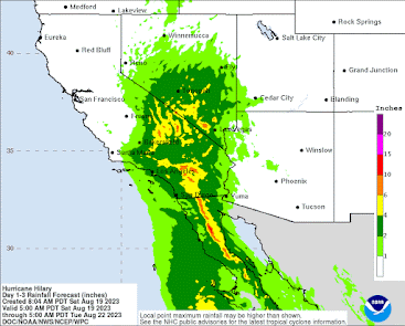
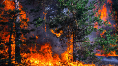
Some locations could get over 6 inches, with the potential for serious flooding. This event will suppress wildfires over central and southern CA for a long time, ensuring that this will be one of the most benign wildfire seasons in years for the region.
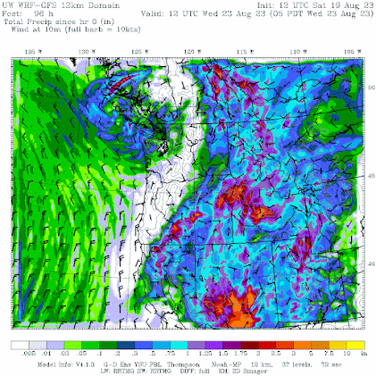
Turning to the Northwest, the predicted rainfall totals through 5 AM Wednesday are shown below. The inland moisture is mainly the result of Hilary. Very substantial amounts in eastern Oregon and portions of eastern Washington. A weak trough of low pressure will bring some light rain to northwest Washington State.
The Smoke
For much of the summer, we have escaped the smoke from the western Canadian fires, but for 48 hr we will experience a taste of it.
The visible satellite image this morning shows lots of smoke over eastern Washington, which is now pushing westward across the Cascades.

Why this change?
Because the protective, and typical, onshore flow of air off the clean-air Pacific has been temporarily replaced by offshore (easterly) flow as a transient area of high pressure has moved to our east (see below). Higher pressure inland and lower pressure near the coast result in easterly (from the east) wind. This configuration is very temporary since low pressure from Hilary will soon be moving northward into Idaho.

The mainly Canadian smoke has caused air quality to decline substantially over eastern Washington to very poor levels (see PurpleAir map around 10 AM Saturday), while western Washington and Oregon still enjoy decent air quality.

But expect air quality degradation west of the Cascades crest as suggested by the latest predictions of the NOAA HRRR smoke system (predicted surface small particle concentrations are shown below)

By 5 PM Saturday, most of western Washington will be experiencing smoke, but nothing like eastern WA.


5 AM Sunday, modest smoke covers the West.

But by 10 PM Sunday, clean air is starting to push inland from the coast. Monday will be a relief from the smoke as marine air surges eastward, atttraced by the low pressure from the decaying tropical storm.