This week I gave a lecture to my junior weather analysis class on the jet stream, a current of strong winds in the upper troposphere (25,000 to 35,000 ft above sea level) in the midlatitudes. So I have been musing about this topic a bit.
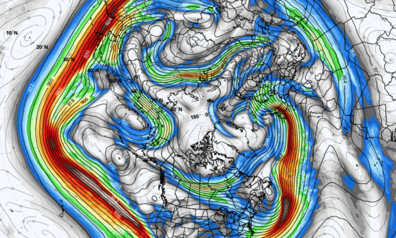
Yesterday I saw the current map of winds at 300 hPa (about 30,000 ft) for the entire Northern Hemisphere and was taken aback: the longest continuous jet stream I can remember.
As shown by the map valid 1 PM Sunday, strong westerly winds exceeding 100 knots stretch from Iran to Baja, California. Halfway around the entire Northern Hemisphere. About 8000 miles.

Looking closer, the entrance to the jet stream is over Iran, passing over northern India and then China before heading out into the Pacific.


With such an extraordinary jet stream in existence, I wondered where the air that reached, say, San Diego was during the previous days.
To answer this question, I ran the NOAA Hysplit trajectory model, creating what is called “back trajectories” ending at various elevations above San Diego (see below). I traced the air back ten days.
Not unexpectedly, the air could be traced back over China and Iran over a week before!

Now considering the current world situation and past concerns about Chinese spy ballons, perhaps we should keep this as a little secret just between us. 😊