The meteorology of a region does not necessarily follow the calendar, and that is certainly true for the Northwest.
Calendar autumn–starting at the fall or autumnal equinox– begins on September 23.
But meteorological autumn in the Northwest generally starts the last week of August, with increasing precipitation and declining temperatures.
And this year will be no exception.
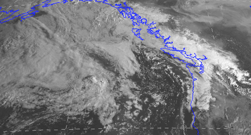
The satellite image this morning shows clouds and showers over the Northwest and developing weather systems offshore…with our name on it!
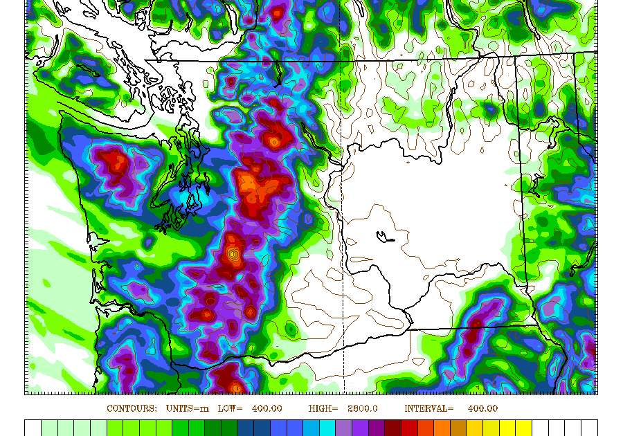
Showers and thunderstorms have moved through the region during the past several hours, as shown by 6:30 AM weather radar composite below. Particularly heavy showers over northeast Washington.

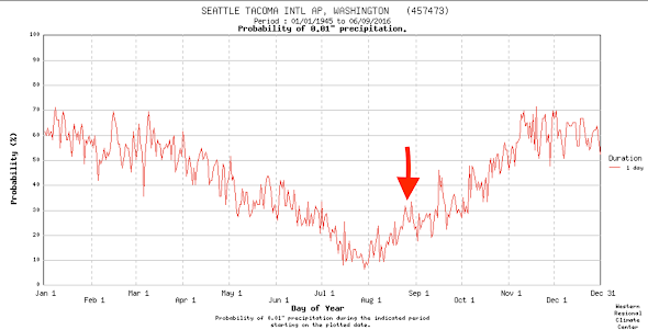
To gain some insight into our regional climatology, check out this graph of the climatological probability of receiving at least 0.01 inch of precipitation in a day at SeaTac Airport (with an arrow indicating today). On average there is a huge increase in precipitation probability between the last days of July (around 8%) to today (about 30%)
Major atmospheric circulation changes have already started, with an increasing north-south temperature difference and the acceleration of the jet stream.
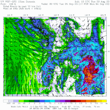
The latest high-resolution prediction of precipitation accumulation over our region through Friday at 5 PM (starting 5 AM this morning) is shown below. Much of the region, except the lower Columbia Basin, will get a good wetting, with particularly heavy amounts in the north Cascades and the Oregon Cascades, as well as the northern Rockies.
Well placed to knock down some of the current wildfires.

The prediction of precipitation total for the subsequent 72 h shows continued precipitation west of the Cascade crest.
Temperatures will be far cooler than we have dealt with during the past months, as illustrated by the extended forecasts at Seattle and Pasco (from the National Weather Service National Blend of Models). In Seattle, highs only around 70F Wednesday and Thursday, a brief warm spell from Friday through Sunday (reaching 81F), and back to around 70F the following week.

Pasco in the Tri-Cities only warms to the mid-80s.

The extended range 6-10 day forecast from the NOAA Climate Prediction Center shows cooler than normal and wetter than normal conditions expected.

This change in weather takes place at a critical time since we are now in the period when western Washington and Oregon are traditionally vulnerable to westside fires driven by strong easterly winds.
But not this year.
Finally, there is a definitive indication of when a major cool-down will is occurring, one supported by the experts in the City of Seattle:

_________________________________________
I am teaching Atmospheric Science 101 this fall in hybrid mode.
You can attend in person or online.
And I would certainly welcome any UW undergraduate or graduate students.