
This story is about a ride that took place in 2013 on the original Oregon Backcountry Discovery Route, which was developed by the Oregon Off-Highway Vehicle Association. The nonprofit Backcountry Discovery Routes organization developed a new ORBDR that was released in 2023. For more information, visit the Backcountry Discovery Routes website. –Ed.
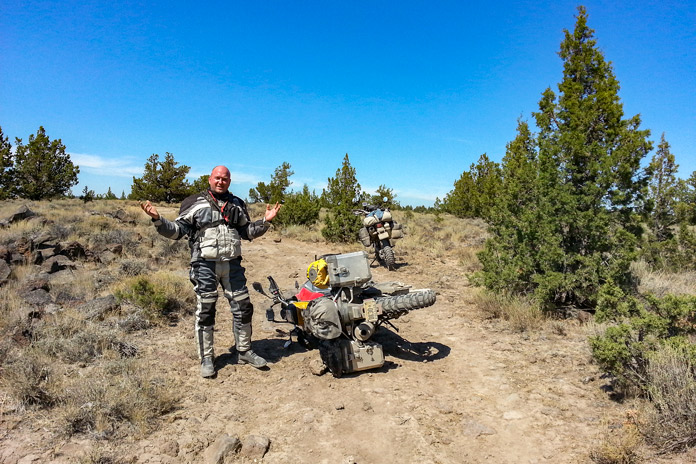
When your bike topples over in the middle of nowhere, when your bike and its week’s worth of gear weigh more than 600 lb, when you’re hot and sweaty and tired, it’s good to have friends along to lend a hand.
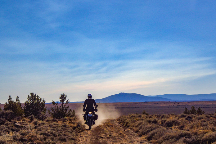
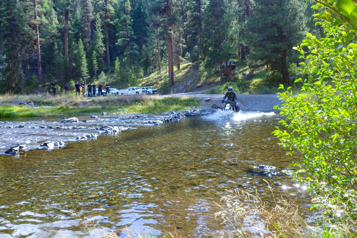
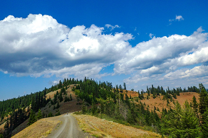
We were three days and nearly 300 miles into the 750-mile, California-to-Washington Route 5 of the Oregon Backcountry Discovery Routes (ORBDR), a network of off-road routes crisscrossing the state’s vast national forests. While struggling my way up a technical jeep road full of embedded rocks, I high-centered the BMW’s skid plate, dabbed my left foot into a hole, lost my balance, and toppled over in a big, dusty heap.

Lead rider Paul was off in the distance, so sweep rider Marten navigated around me, parked his bike on a level spot, and came back to help. Other than some badge-of-honor scratches on the bike, the only damage was to my pride, and I was soon making forward progress again.
Backcountry Discovery Routes is a nonprofit organization that establishes and preserves off-highway routes for dual-sport and adventure motorcycles. BDR has mapped and documented north-south routes in most states west of the Rockies as well as mid-Atlantic and Northeast routes and shorter BDR-X routes. Inspiration for these routes came from the ORBDR, which, according to BDR’s website, “was created a few decades ago by Bob and Cheryl Greenstreet as a concept to promote managed travel in the backcountry” and is maintained by the Oregon Off-Highway Vehicle Association.
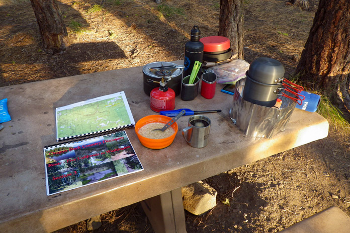
Paul, Marten, and I wanted to ride the granddaddy of the Backcountry Discovery Routes, so I bought paper maps for Route 5 from OOHVA and Paul spent two weeks creating GPS tracks for us. (GPS tracks are now available upon request when maps are purchased from OOHVA.) Since most of the ORBDR is at 4,000-8,000 feet of elevation, we planned our trip for August to avoid snowpack.
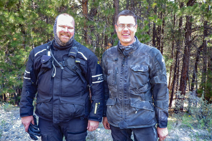
A long-time adventure-riding and homebrewing buddy of mine, Paul Beck, is a computer guy. Since he created our tracks and led our group (his GPS was the only one that worked reliably), we dubbed him the Navigator. Marten Walkker, another riding buddy, is a master carpenter. He made his own tailbag, auxiliary gas tank, toolbox, and highway pegs for this trip, so we called him the Fabricator. And since I kept a journal, shot photos, and sent daily postcards to my wife, I became the Chronicler.

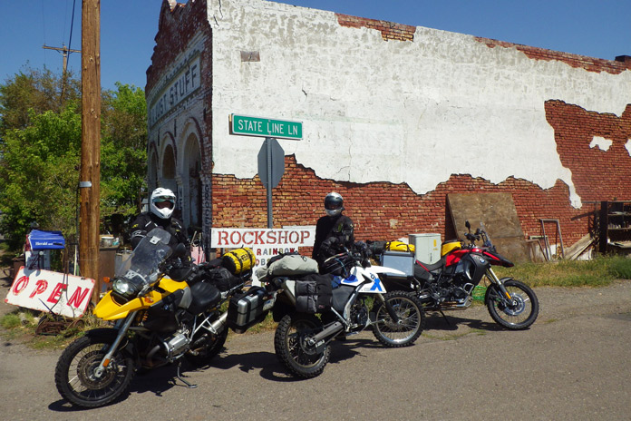
Similar in pace and temperament and always ready for a quick laugh, we were compatible travelers, like the Three Amigos. We were all of German descent and riding BMWs – Paul on an R 1200 GS, Marten on a G 650 Xchallenge, and me on an F 800 GS Adventure – so Drei Freunde is more accurate, but it doesn’t exactly roll off the tongue.
Departing from Ventura on California’s southern coast, our first 750 miles were on pavement as we made our way up to the northeastern corner of the state. A half-mile before the Oregon border on the afternoon of our second day, we turned from U.S. Route 395 onto the unpaved County Road 2 and entered Modoc National Forest as we climbed into the Warner Mountains. We had to shift our brains from the grip and monotony of wide-open pavement to the delicate balance of riding top-heavy adventure bikes on loose, uneven dirt and gravel. The road leveled out within a few miles, and we turned north, passing through the green meadows of the (not so) Dismal Swamp and crossing into Oregon.
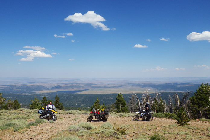
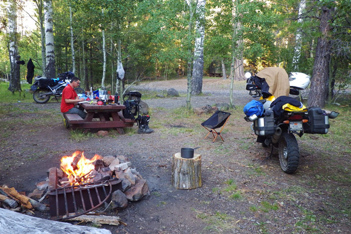
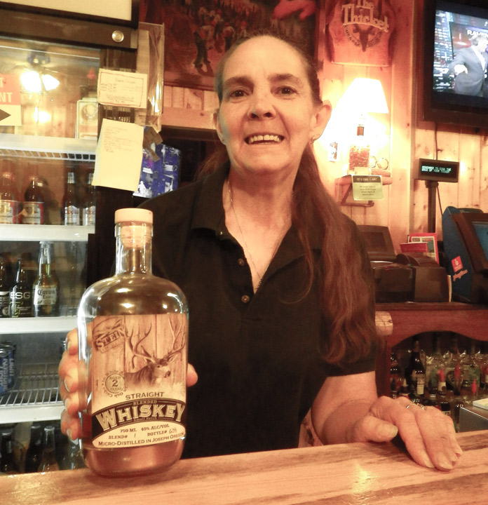
After riding a challenging spur road up to the top of 8,000-foot Crane Mountain for panoramic views and navigating through a herd of cows, we stopped at Willow Creek Campground, which was deserted. We crossed a cattle guard to get into the campground, and even though it was surrounded by a fence, we still had to pick our way through a minefield of cow patties to set up our tents. After bathing and rinsing out our sweaty clothes in the creek (but not drinking the water), we fortified ourselves with backpacker meals and relaxed around the campfire, swapping stories and sipping whiskey.
The OOHVA’s detailed, full-color ORBDR map booklets offer the following words of advice: “Your journey will be one of few contacts with others. One needs to plan for being self-sufficient. Travel with others is highly recommended. If one’s means of transport fails, it can be a really, really long hike, and it could be many days before someone comes along.”
Over the course of five days on the ORBDR, we saw only a handful of people – a few ranchers, a couple of 4×4 trucks, and the occasional hunter. We traveled as a group, each of us brought our own food, water, and gear, and we carried a SPOT satellite tracker/communicator. Gas was available every 100 miles or so, often in small towns or at convenience stores near the route, and we filled up our tanks and hydration backpacks at every opportunity.
“Much energy has been spent to provide you with maps that provide the information needed to successfully navigate without on-ground signs,” says the OOHVA. We saw only a few faded, old ORBDR signs over the entire 750-mile route.
See all of Rider‘s Western U.S. motorcycle rides here.
“The development of route was financed by the Oregon ATV Allocation Funds,” said Leonard Kerns, president of the OOHVA, in a blog on Touratech-USA’s website. “On-the-ground signs were placed and the route was dedicated in the summer of 2000. Unfortunately, it did not take long for people opposed to the route to bring legal action. Support from the Forest Service and Bureau of Land Management was lost and all remaining funds were used to remove the signs. At that point, OOHVA stepped in and created the maps using GPS to navigate.”
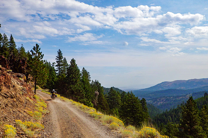
The ORBDR is on public land, so anyone can travel the route using a street-legal vehicle, but much of it passes through areas used for grazing and logging. We crossed dozens of cattle guards and stopped often to open and close barbed-wire gates. Forest land in central and eastern Oregon is all but empty, yet it’s crisscrossed with so many access roads that without GPS tracks and paper maps, getting lost is all but assured.
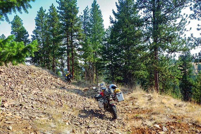
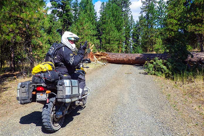
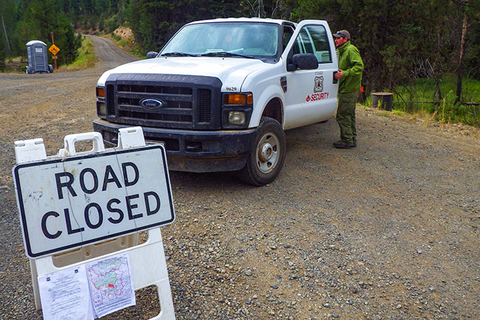
The OOHVA’s maps were created in 2002, and in the years since, some roads have been closed and new ones have been cut. Even following the purple line on Paul’s GPS, we still made wrong turns or hit dead-ends and had to figure out how to re-route ourselves. We also encountered the unexpected, such as fallen trees and man-made barricades. Therein lies the adventure. Riding a backcountry route is not like following the Yellow Brick Road; it requires not only preparation and riding skills but also teamwork, patience, and adaptability.
We quickly established a routine: waking early to heat up water for coffee and oatmeal using portable stoves, breaking camp, riding for several hours, stopping for lunch and gas, riding for several more hours, then stopping early to set up camp and relax. Paul was always in the lead, which meant his gear stayed clean and we had someone to blame for wrong turns. I followed Paul and Marten followed me, and even with space between us the dust filled our noses and covered our gear, making zippers and buckles hard to open and close. We planned to camp every night, but it didn’t work out that way, to our surprise and benefit.
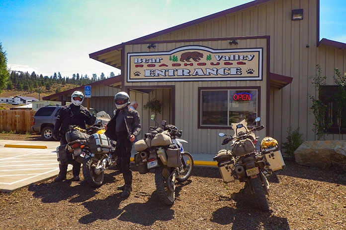
During our five days on the ORBDR, we experienced a steady stream of good luck. We enjoyed mostly warm, dry weather and had no flat tires, breakdowns, or injuries. Rather than eating jerky and energy bars for lunch, we usually found a cafe in a small town where we’d refresh ourselves with air conditioning, limitless iced tea, and other luxuries, and there was always a gas station nearby to fill up and resupply.
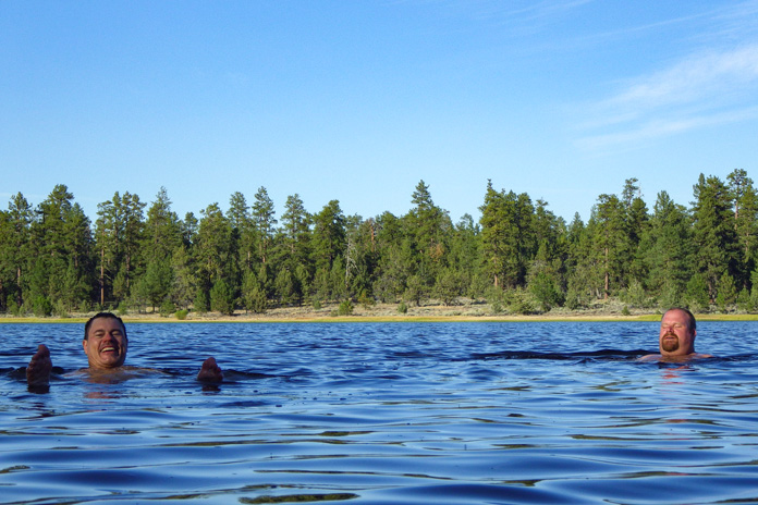
During the three nights we camped, there was either a cool stream or a lake we could swim in to wash off the dust and relax our creaky joints. On our second day on the ORBDR, after a challenging, tiring section with lots of sand and rocks, we ended up in the town of Christmas Valley, where the Lakeview Terrace motel/restaurant spoiled us with cheeseburgers, fries, cold beers, hot showers, and soft beds.
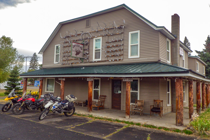
Even when we had to leave the ORBDR to route around the 1,000-acre Vinegar Fire, we got to ride 50 miles on the freshly paved Blue Mountain Scenic Byway and ended up in Ukiah on a damp, foggy night. Instead of pitching tents and eating freeze-dried meals in the rain, we stayed warm and dry at the Antlers Inn and savored burgers and beers at the Thicket Cafe & Bar. We enjoy roughing it, but we’re not too proud to take advantage of good fortune when it lands in our laps.
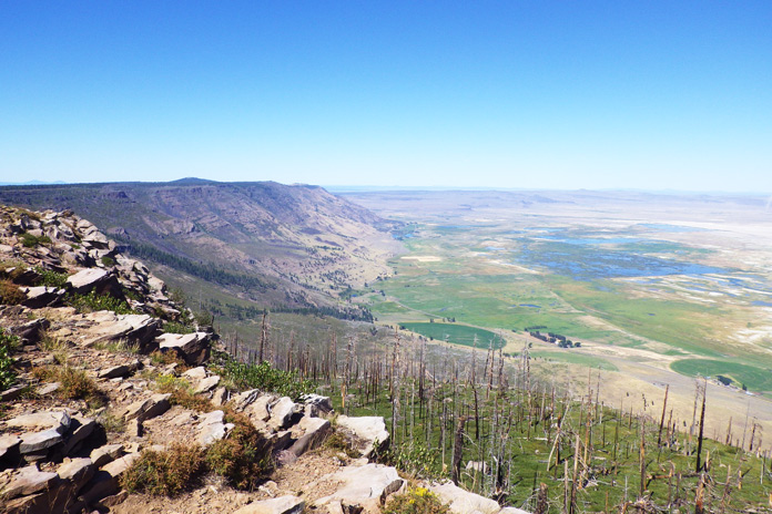
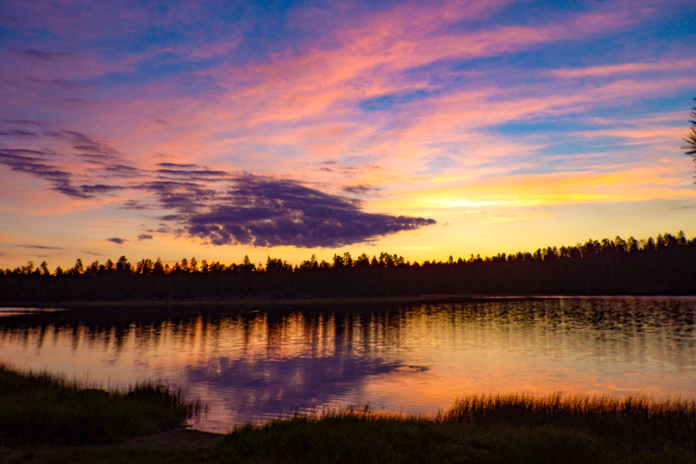
Our five days and three nights on the ORBDR provided us with as much adventure as we could hope for. We rode more than 700 miles on dirt and gravel roads through the backcountry of Oregon, through dense forests, across high-desert plains, along mountain ridges, away from cities and people and normal obligations. We rode through rock gardens and sand washes, forded rivers, and navigated over or around countless obstacles, challenging ourselves and having fun. We had campgrounds to ourselves, where we enjoyed star-filled nights and soul-warming campfires, and we stumbled upon cozy motels and restaurants, where we enjoyed creature comforts.
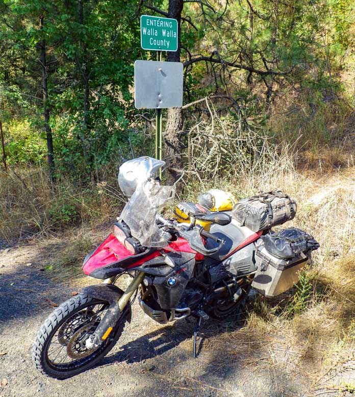
Paul, Marten, and I – the Navigator, Fabricator, and Chronicler – bonded over the experience. When we reached Walla Walla, Washington, the northern terminus of the ORBDR, having ridden 1,500 miles together, we high-fived and celebrated our shared accomplishment. The next day we headed off in different directions, Paul to Seattle, Marten to Calgary, and me home to Ventura, completing an Iron Butt SaddleSore 1000 in the process, but that’s another story.
See all of Rider‘s touring stories here.