If some folks thought that a strong El Nino would protect the region from heavy rain before the new year, they were mistaken.
A substantial atmospheric river-– a narrow current of high-water vapor content– will be heading right into our region starting Monday evening, and the precipitation amounts will be substantial.
Let me show you.
Below is a forecast map of total water vapor content through a vertical column of the atmosphere at 10 PM Monday. The blues and light pinks indicate the largest values.
Atmospheric rivers like this tap large amounts of water vapor in the tropics and subtropics. Moisture also converges into the “river” from the sides, not unlike the water of small streams flowing into a major river along its path.

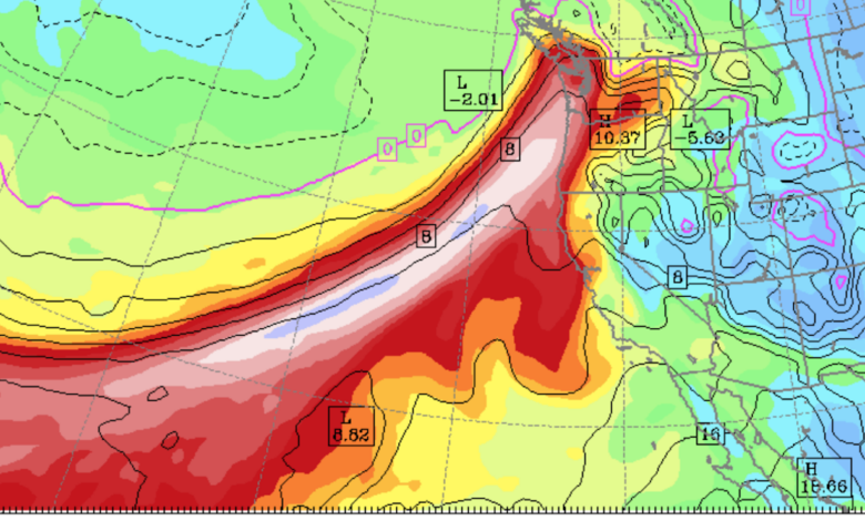
Professional meteorologists generally prefer to look at another measure of the potency of atmospheric rivers called integrated water vapor transport (IWVT), which is water vapor content times the wind speed.
It is a measure of how much water vapor is being transported by the wind and is better correlated with rainfall potential.
Here is the IWVT at the same time as the image above (10 PM Monday). Blues indicate large values.

You will note that there is a lot of moisture coming into the Northwest coast, but little extending to the northeast. Where did all the moisture go?
It rained out!
Below is the forecast total precipitation through Monday at 4 AM (start at 4 AM Sunday). Precipitation for the whole region, but heaviest over the Oregon terrain.
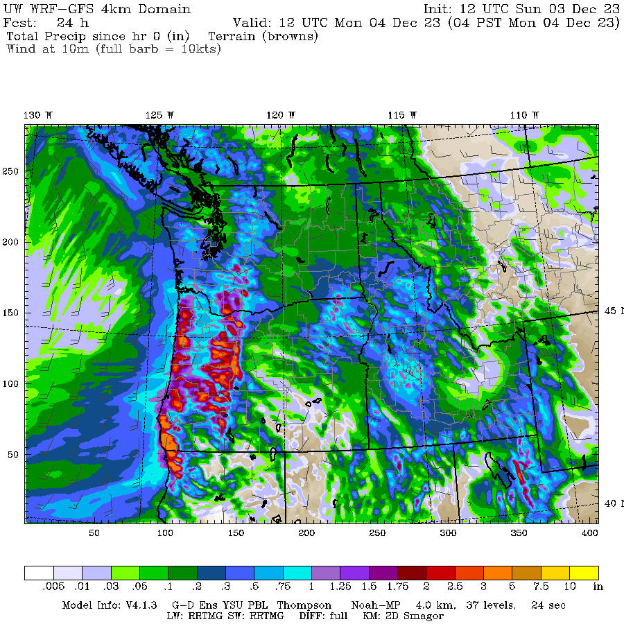
Then the atmospheric river comes in (JAWS music should be played now). The total precipitation through 4 AM Tuesday is impressive, with 7-10 inches over the mountains of Washington and SW British Columbia. Most of that atmospheric river moisture is being pulled out of the atmosphere by precipitation over regional terrain.

One day later even more, particularly over Oregon.

Soils are now saturated throughout the region. Adding this precipitation will result in rapidly rising river levels, some to major flood levels.
Consider the forecast of the NOAA/NWS Northwest River Forecast Center (see below). A number of rivers will get to major flooding (purple) and others to major flooding (red).

Consider the Snoqualmie River near Carnation. It will get considerably above major flood stage and will set a record for the period.

Do you want to see something very, very impressive? Go to Snoqualmie Falls on Wednesday. You won’t believe what you will see.
One thing I can guarantee you. The City of Seattle will be able to bring the water level of its reservoirs way up and there won’t be any talk of low water levels. Take a long shower if you like….😔
Considering that we are in a strong El Nino period, which will probably reduce snowpack in the spring, reservoir managers should try to save as much of this water as possible.