We are celebrating 50 years Landsat The first satellite was launched on July 23, 1972. The latest satellite in the series, Landsat 9, was launched in September 2021.
Landsat shows us the Earth from space. For 50 years, the mission has been collecting data on forests, farms, urban areas and freshwater on our planet, creating the longest continuous record of its kind. Decision makers globally use freely available Landsat data to better understand environmental change, manage agricultural practices, allocate scarce water resources, respond to disasters and more again.
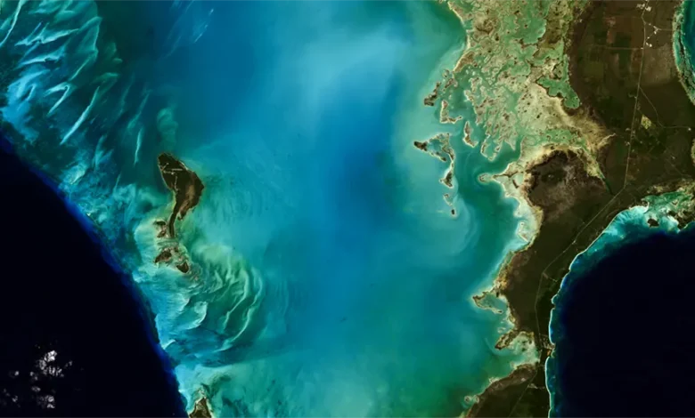
This natural color image of Eleuthera Island, Bahamasimaged by Landsat 9 on January 18, 2022. Between Landsat 8 and Landsat 9, the Landsat program provides coverage of the entire Earth’s surface every eight days.
Image credit: Michelle Bouchard using Landsat data from USGS
Last updated: July 22, 2022
Editor: Yvette Smith