
The Pacific Northwest is a meteorological kill zone.
The place where fronts come to die.
Time and time again, there is a relatively strong Pacific front offshore approaching the coast, with a dramatic wind shift, strong gusty winds, and often very heavy frontal precipitation. On the coast, it is a real barn-burner.

But over the interior of western Washington and Oregon, it is profoundly weaker, and then almost imperceptible over the Columbia Basin.
Let me show you an example during last Wednesday afternoon. At 1:05 PM an intense front was offshore, made evident by the radar image showing intense echoes (red colors) offshore. The corrugation of these echoes indicates strong wind shear and frontal intensity (known as a narrow cold frontal rainband).

A few hours later (3:32 PM) after the front made landfall, the intense frontal structure was gone–no more red echoes!

To show that the surface frontal contrasts have weakened, consider the wind and pressure observations at an offshore buoy off the WA/OR coast (left panel) and another observation location in central Puget Sound (West Point lighthouse)(right panel).
Offshore, the is a very sharp increase in wind gusts (red) and sustained winds (blue), with gusts hitting 43 kts! Subsequently the winds dropped rapidly at the buoy. The front was associated with a very large pressure decline (green line), followed by a rapid rise after frontal passage. Classic for a strong front. Over Puget Sound, the pressure decline was less dramatic and winds only gusted to 21 knots. In fact, the stronger winds were in the period after the frontal passage.

At Yakima, you would hardly know any wind change had happened (see below).

I could show you a dozen other cases just like this.
We can gain additional insights into this frontal weakening process (called frontolysis in the business), by looking at our model simulations.
Below are some simulated radar images from Nov. 9th from the UW modeling system.
At 2 PM, the modeling system has a strong front offshore (note the red line indicating heavy rain)

By 6 PM the front had weakened and headed into the Cascades, which increased the precipitation a bit on the upper slopes.

And at midnight, a remnant weak amorphous ban of rain is over eastern Washington. A sad ending for a previously proud front.

So why do fronts weaken over western Washington?
The key issue is the terrain, starting with the coastal mountains, including the Olympics (see terrain map below). The terrain tears apart the lower structures of the fronts, disrupting the circulations that support frontal intensity (such as strong low-level convergence).
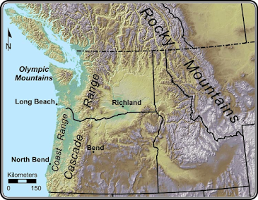
And if the coastal mountains don’t do a good enough job, the higher terrain of the Cascades helps to finish the weakening process.