During the autumn, as the jet stream strengthens and moves south, our weather becomes more variable, with very pleasant warm periods interrupted by significant rainfall.
And that is what is in store for us during the next ten days, after a much wetter than normal September.
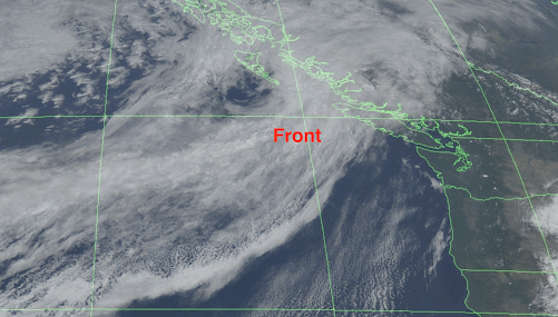
The current visible satellite image shows a weak front lurking offshore (see below), and this front is moving in tomorrow morning, bringing rain to the commute.
So Monday will be wet and cloudy, with the total precipitation over the region being modest; the high terrain will receive perhaps a half inch of rain.

Enough to ensure no new wildfires and to keep the few smoldering ones from expanding. Highs only in the mid-50s around Puget Sound, and mid-60s in the Tri-Cities.
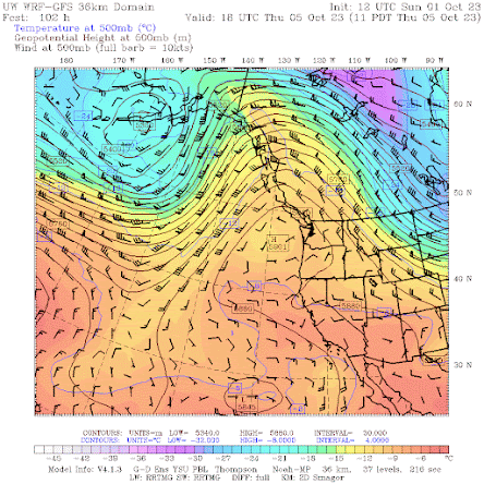
Then we get several days of dry conditions and warming, as a major ridge of high pressure builds over the eastern Pacific and slowly drifts over the West Coast (see upper-level… 500-hPa height– for 11 AM Thursday).
Temperatures in western Washington will slide up into the lower 70s, with totally dry conditions. Very nice. Perfect for an autumn hike, walk, or bike ride.
Things will be fine into next weekend, but then the evil reflection of the ridge– a strong following trough of low pressure– will move in.
The 72h precipitation total through 5 AM, Wednesday 11 October is substantial, with some of the mountain areas receiving 3 to 7 inches. More the terrain of SW British Columbia.

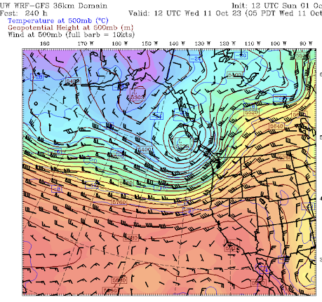
During that period, a deep upper-level trough will form over the eastern Pacific (see forecast chart for Wednesday morning, Oct 11). California will escape the cool/wet onslaught.
And this upper-level trough will spawn ANOTHER deep surface low off our coast–so expect some big waves hitting our ocean beaches (see sea level pressure forecast for 2 AM next Wednesday).

Bottom line: current forecasts suggest a typical October for our region.
______________________________________
Final reminder. I am teaching ATMS 101 now and those over 60 can sign up through the UW Access program as an auditor for about $25.