Numerical weather prediction has improved dramatically over the past decades, providing potent warnings for extreme weather, such as hurricanes.
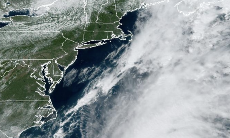
There are few better examples than the prediction of Hurricane Lee, which will make landfall near the Maine/New Brunswick border late Saturday.

The U.S. global model, the GFS, has been spectacularly skillful in predicting this storm, well more than a week ahead.
The latest forecast run shows the storm making landfall near the international border around 5 PM PDT on Sunday. That is a 54-h hour prediction This is so close enough in time…and so consistent with other model forecasts… that you can be assured that this is close to what will happen.

But how did extended forecasts do?
The 72-h prediction is pretty much the same.

The 126 h prediction is nearly identical in position:

The 198 hr (8.25 day) forecast has a strong hurricane in pretty much the same location.

Folks, this is a stunningly good forecast for over a week ahead.
Professor Brian Tang of the University of Albany has a wonderful website that verifies the hurricane track (position) forecasts of major modeling/forecasting systems. The results for Hurricane Lee are shown below for forecasts of 120 hours (5 days) or less.
In general, the track accuracy gets better for shorter forecasts…which makes sense. But let’s compare the American model (blue color, AVNO), the European Center model (red color), and the UKMET office model (green color). The human (official) forecast is shown in black.
Wow. The American model is STUNNINGLY accurate at all projections in time.
It is FAR better than the nominally top two global modeling systems in the world: the European Center and UKMET. The forecast error is under 100 km (60 miles) for all projections shown.
Extraordinary.
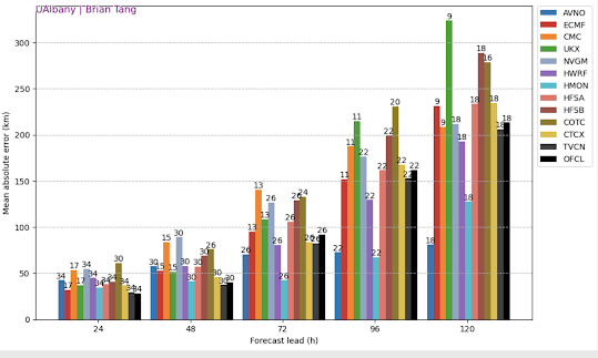
The model forecasts are better than the official Hurricane Center forecasts….I suspect that humans are probably hedging their bets with the European Center model solution.😅
This was a truly excellent forecast and not the only success for the American model this season. Hopefully, this extraordinary performance will be persistent for future storms, perhaps reflecting recent improvements in the U.S. global modeling system.
Finally, I should note there are real policy implications of the rapidly advancing weather prediction skill now available to decision-makers. Excellent forecasts can help protect people and economic assets from extreme weather.
Better forecasts are the first line of defense against severe weather.
Better forecasts have great potential for reducing the negative impacts of global warming.
One of the reasons I have spent some time trying to calm down some who are panicking over global warming and extreme weather.
Climate-related deaths are down…and I mean WAY down. Better adaptation and a richer world have contributed, but so have better forecasts.

Importantly, we have only begun taking advantage of improved forecast skill.
The winds on Maui were nearly perfectly predicted on August 7-8 of this year, yet 115 people died and nearly 10 billion dollars in damage was done. We could have easily stopped the carnage, by shutting off the power and effectively evacuating the population.
Most major wildfires are related to strong winds and such winds are often forecast with great skill. Few should be a surprise.
In summary, coastal New England has had nearly a week to prepare for strong winds and heavy precipitation (over northern Maine)– and we can be proud of the technological advances and investments in NOAA and in other government agencies that made such forecasting prowess possible.