A tropical depression in the Gulf of Mexico strengthened into Tropical Storm Debby on Saturday as it moved across the Gulf of Mexico toward Florida.
Forecasters at the National Hurricane Center say the storm currently has maximum sustained winds of 40 mph. Debby is located about 100 miles west-southwest of Key West, Florida, and is moving northwest at 15 mph.
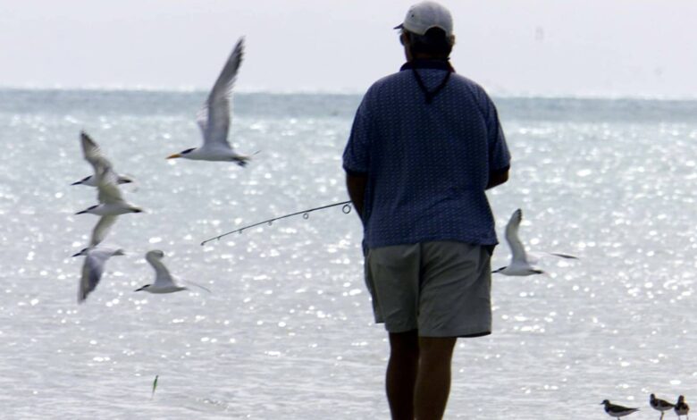
Winds and thunderstorms were widespread across a wide area, including southern Florida, the Florida Keys and the Bahamas.
Hurricane Debby is expected to bring heavy rain and coastal flooding to much of Florida’s Gulf Coast Sunday night, and forecasts show the system could make landfall as a strong tropical storm or hurricane on Monday and move across northern Florida into the Atlantic.
Forecasters warn that heavy rain could hit northern Florida and the Atlantic coasts of Georgia, South Carolina and North Carolina early next week.
Debby is the fourth named storm of the 2024 Atlantic hurricane season following Tropical Storm Alberto, Hurricane Beryl, and Tropical Storm Chris, all of which formed in June.
The National Hurricane Center in Miami forecasts the system will strengthen as it moves off the southwest coast of Florida, where the water is extremely warm with temperatures reaching 92 degrees Fahrenheit (33 degrees Celsius) this week.
The system could make landfall as a severe tropical storm or hurricane.
Forecasts show Debby could make landfall as a strong tropical storm or hurricane on Monday and pass north of Florida into the Atlantic, where it is likely to remain a tropical storm threatening Georgia and the Carolinas early next week.
Tropical storm warnings have been issued for most of Florida’s West Coast and the Dry Tortugas, and hurricane warnings have been issued for parts of the Big Bend and Florida Panhandle. A warning means hurricane conditions are expected within 36 hours, while a warning means they could occur within 48 hours.
Tropical storms and hurricanes could cause river flooding and inundate drainage systems and waterways. Forecasters warn of 5 to 10 inches (125 mm to 250 mm) of rain, which could cause flash flooding and “locally significant” urban flooding. Forecasters also warn of moderate flooding in some rivers along Florida’s West Coast.
Some of the heaviest rain could actually hit next week in an area along the Atlantic Coast from Jacksonville, Florida, north through coastal Georgia, South Carolina and North Carolina. The storm is expected to slow after making landfall.
“We could see some stalling or meandering around the coastal areas of the southeastern United States,” National Hurricane Center Director Michael Brennan said at a press briefing on Saturday. “So that will exacerbate not only the risk of rain but also the potential for storm surge and some strong winds.”
Flat Florida is prone to flooding even on sunny days, and the storm is expected to bring storm surges of 2 to 4 feet (0.6 to 1.2 meters) along much of the Gulf Coast, including Tampa Bay, with higher tides of 3 to 5 feet (0.9 to 1.5 meters) farther north in the sparsely populated Big Bend area.
Forecasters warned of “life-threatening storm surge flooding” in an area that includes Hernando Beach, Crystal River, Steinhatchee and Cedar Key. Officials in Citrus and Levy counties ordered mandatory evacuations of coastal areas, while those in Hernando, Manatee, Pasco and Taylor counties called for voluntary evacuations. Shelters were open in those counties and several others.
A tropical storm warning has been issued for the southern Florida Keys and multiple wind gusts over 45 mph have been recorded.
Florida is preparing for flooding.
Florida Governor Ron DeSantis has declared a state of emergency in 61 of the state’s 67 counties, and mobilized 3,000 members of the Florida National Guard.
In Tampa alone, officials distributed more than 30,000 sandbags to prevent flooding.
“We’ve cleared storm drains. We’ve inspected and loaded generators. We’re doing everything we need to be prepared for a tropical storm,” Tampa Mayor Jane Castor said.
Christina Lothrop is general manager at Blue Pelican Marina in Hernando Beach, a barrier island about 50 miles (80 kilometers) north of St. Petersburg. She said Saturday felt like a normal summer day, with the public ramp across the street packed with people launching boats.
“It’s pretty normal these days, but it’s also pretty strange,” Lothrop told The Associated Press by phone.
However, workers at her marina had been preparing since Tuesday, including securing the boat to its rack, putting away the toolbox and tying everything down.
“Right now, the work we do is mainly mooring boats,” Lothrop said.
Before closing on Saturday, Lothrop planned to lift the computers off the floor and put sandbags and tape on the door. Last year’s Hurricane Idalia pushed about a foot of water into the store.
Betti Silverman, whose Crystal River home is under evacuation orders, said she doubted her family would leave. Silverman’s waterfront home was flooded by Hurricane Idalia shortly after they moved in, destroying boxes and furniture stored in the garage. But she said the storm’s forecast was not as severe.
“We’ve lived in Florida our whole lives — in South Florida — so hurricanes aren’t really that big of a deal,” Silverman said.
On Friday, crews pulled floating cranes out of a bridge project across Tampa Bay, tied down 74 barges and 24 floating cranes and anchored them until the storm passed, project engineer Marianne Brinson told the Tampa Bay Times. Crews also placed land-based cranes on either side.
Pinellas County has paused a $5 million beach restoration project, in part due to erosion from past storms.
For some, the name Debby evokes bad memories of the 2012 tropical storm of the same name that caused $250 million in damage and eight deaths, including seven in the Sunshine State. That storm dumped torrential rain up the West Coast and into northern Florida, including an astronomical 29 inches (730 mm) of rain south of Tallahassee.
More storms in the Pacific, but no threat to land
Meanwhile, far from Mexico in the Pacific, Hurricane Carlotta continues to move west with maximum sustained winds of 90 mph (145 km/h). The hurricane center said Carlotta will begin to lose strength on Sunday and is likely to dissipate into a thunderstorm remnant in three to four days.
Farther west, Tropical Storm Daniel formed in the Pacific on Saturday, but was 1,500 miles (2,400 kilometers) from the southern tip of Baja California and was also expected to dissipate without making landfall.