Earth Observation Organization for Ukraine (EO4UA) will determine Ukraine’s agricultural damage and environmental devastation
CloudFerro, a cloud service provider and operator of the CREEDIAS platform, has launched the EO4UA (Earth Observation for Ukraine) initiative to support Ukrainian agencies and international organizations in assessment of environmental damage caused by military operations in Ukraine. The partners of the initiative are Kyiv Polytechnic University, AIRBUS Defense & Space, SatAgro, the Center for Applied Geoinformatics of the Institute of Geodesy and Mapping Science, and the Center for New Technologies of the University of Warsaw .

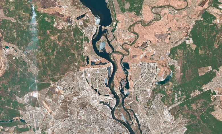
A lot of. Satellite image: Capital of Ukraine – Kiyv. Copernicus Sentinel 2 L2A, image taken on March 21, 2022.
The war in Ukraine is causing great damage to the environment and to agriculture. Ukraine is an important producer and exporter of cereals, oilseeds and sugar beets. The country’s agricultural land accounts for 42 out of 60 million hectares. As a result of the ongoing war, goods from Ukraine will not be able to reach importers, most of which are listed as underdeveloped countries with food shortages. High inflation coupled with an embargo on Russian goods (including fertilizers) will increase food prices and consequently increase the number of undernourished people in the Asia-Pacific region. Sub-Saharan Africa, Middle East and North Africa (FAO, Food and Agriculture Organization of the United Nations).
At the same time, the effects of war will be evident in Europe, which consumes half of Ukraine’s sunflower oil production for many food products. They will also be seen in massive deforestation and wildfires caused by military action.
Russia’s invasion of Ukraine poses a huge threat to the global environment and food security. Therefore, the monitoring of Ukraine’s environment and crop production is crucial for taking appropriate corrective actions. To assess the environmental damage and support the Ukrainian authorities and international organizations, CloudFerro, a cloud computing service provider, has started the EO4UA initiative.
EO4UA operations will be performed in the CREODIAS cloud environment, providing high-performance computing (HPC) power along with a large Earth Observation (EO) data warehouse of satellite images. The archive will contain various data sets, such as satellite imagery from the European Sentinel satellite, crop classifications and field boundaries, and forest fire zones, indispensable for the classifications. multi-purpose environment. The repository will also store end-user analysis results with generated products, which will facilitate further research.
-
environmental monitoring Ukraine, in particular food production and forestry,
-
help Ukrainian scientists continue their research work, gather EO experts to conduct research for Ukraine,
-
provides a CREEDIAS cloud environment integrated with a large Earth Observation (EO) data warehouse,
-
support future research for Ukraine by sharing the results of analysis previously conducted by EO4UA partners,
-
provide the public with information on the state of the environment and agriculture in Ukraine.
Members of the EO4UA Initiative include satellite data processing experts from the private, public and academic sectors who aspire to support Ukraine by providing expertise. on EO data analysis and collaboration with Ukrainian scientists. This initiative is constantly being opened to new members who will make a significant contribution to help Ukraine.
A lot of. Satellite image: Capital of Ukraine – Kiyv. Copernicus Sentinel 2 L2A, image taken on March 21, 2022.
The source: Prowly